Bio-acoustician Irene Roca is a postdoctoral researcher at HIFMB. In March and April 2022, she takes part in a research cruise of the FS Polarstern through the Southern Ocean. The expedition starts in Capetown, traverses the Weddell Sea and ends in Punta Arenas in Chile.
The mission of the PS129 expedition is to gather new data to contribute to the on-going investigation of the water masses of the Weddell Sea and adjacent oceanic regions and the inherent ecological and chemical cycles.
47 scientists, 44 crew members and four helicopter services contribute to the expedition’s success.
As part of the HAFOS (Hybrid Antarctic Float Observing System) and acoustics team on board, Irene’s tasks will primarily evolve around the recovery and redeployment of deep-sea moorings featuring current meters, temperature and salinity sensors, sound sources and passive acoustic recorders.
As far as the daily work on the ship and the data connections allow, she will share an insight into her tasks as well as her impressions and experiences beyond research with us here.
Click on the dates below to read Irene’s reports.
Hello everyone, my name is Irene, I’m a postdoctoral fellow at HIFMB specialized in eco-acoustics. Over the next few months, I will have the amazing opportunity to be on board of the research vessel and icebreaker Polarstern and see for the first time one of the last pristine ecosystems in the World –the environment from which the acoustic recordings I work with come from.
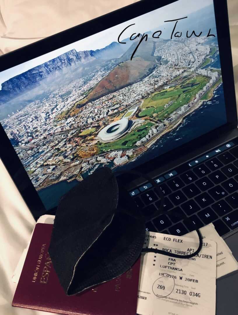
But to reach the ship we first need to travel from Oldenburg, Germany, all the way to Cape Town, South Africa (“the adventure lover’s playground”), and once there go into quarantine. Yes, for 10 long days we will be in “The Mother City”, holed up in our hotel rooms in quarantine.
After more than 15 hours of actually quite smooth traveling, we arrive to the international airport of Cape Town. I anticipate the wonders I’ll see outside and –still all masked up– I’m excited and eager to leave the airport and step in the open-air. I finally see and feel the sun! But there is not much time to enjoy it, we need to get in our bus that will drive us to our hotel into quarantine. Through the bus windows we see shanty towns which dominate the landscape around the road and are a common sight during the 20 minutes bus ride. We also see Table Mountain in the distance and glimpse the red rooftops of Cape Town university at its base. We finally enter the Century City with its luxurious buildings that strongly contrast with what we have previously seen on the road.
The hotel looks big and elegant and we are quickly hurried to our respective rooms that will be our isolated residence for the next 10 days. All our needs are however well covered here. We even have a little mattress and one hand-size dumbbell to exercise. For every meal, food is brought to us and left in front of the door for us to pick up. We are also tested for COVID every second day.
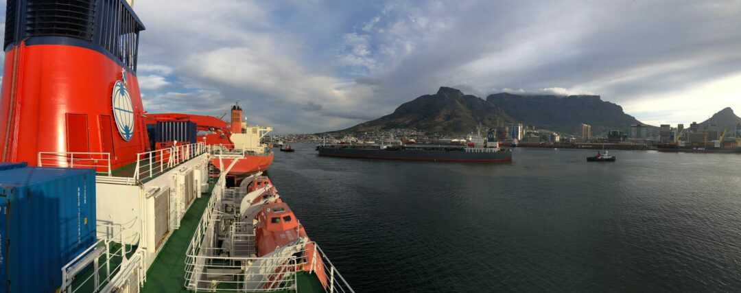
The ten days of quarantine have already passed. Finally, and happily, on board of the Polarstern we form a group of 44 crew members and 49 participants including pilots, technicians, engineers and scientists. We are all ready for the PS129 expedition to start!
Our mission will be to gather new data to contribute to the on-going investigation of the water masses of the Weddell Sea and adjacent oceanic regions and the inherent ecological and chemical cycles. The overarching goal is to enhance our understanding of the Southern Ocean’s role in the global climate system and of the ecological adaptation and dynamic responses of marine biota to anthropogenic perturbation, including climate change and noise pollution.
In order to accomplish our mission, we will voyage on board of the RV Polarstern from Cape Town, South Africa, to the Southern Ocean. We will sail south until reaching the Antarctic continent and zig-zag afterwards through the Weddell Sea to the tip of the Antarctic Peninsula, to finally cross the Drake Passage to end our expedition. All the way through the Weddell Sea, we will regularly stop at specific locations (more than 90 stations) to collect the aforementioned prised data.
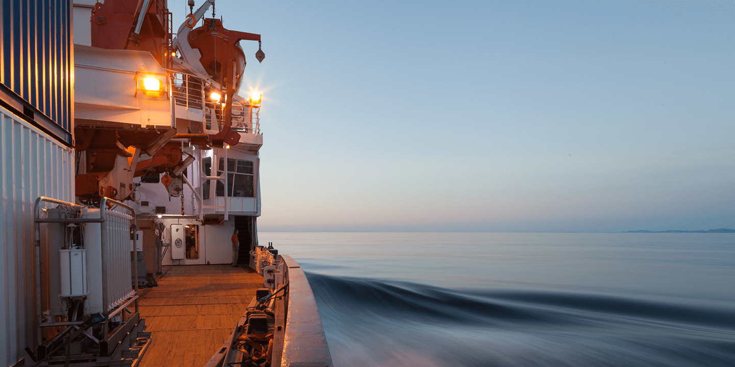
Being the first time that I am on board of the Polarstern, I am quite impressed with its view when we arrive at the port. With its 8 decks, ~ 118m length, 25m width, and the practical compactness in which the space is arranged inside, it takes me a few seconds to recognize the scene each time I pop out somewhere following a staircase. I will probably need a couple of days to adjust to this interesting maze. The upper levels comprise among others the cabins, kitchens and the bridge. The lower decks comprise the laboratories, workshops, storage and engines rooms. All of them full with specialized equipment in all shapes and sizes that will serve one way or another to the purpose of the expedition.
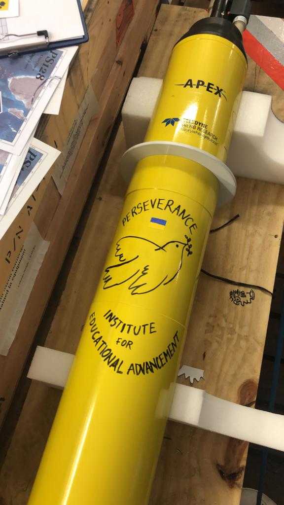
Today we are deploying the first research instrument! It is a biogeochemical Argo float adopted and named by children from the climate class from the Institute of Educational Advancement in Pasadena, CA. With this float –Perseverance–, we also send a message to the world wishing for peace in spite (or because) of the current political situation.
One important task carried out on board by some members of the Hybrid Antarctic Float Observing System (HAFOS) group, and as part of a larger global oceanic observing system, is relishing Argo floats into the Ocean. In an effort to overcome the observational constraints posed by high latitudes and the deep ocean waters, Argo is an internationally financed and organized array of >3000 autonomous profiling floats with public, near-real time data access.
Argo floats are robotic instruments that drift with the ocean currents and move up and down between the surface and a mid-water level and surface regularly to be localized and transmit their data. As the Argo floats drift, they collect data describing the temperature and salinity of the water. Some of the floats measure other properties that describe the biology/chemistry of the ocean as well. These data help us understand the oceans’ role in earth’s climate and hereafter, be able to make improved estimates of how it will change in the future.

During PS129, 37 Argo floats will be deployed including 23 ice-resilient ones and 9 biogeochemical ones appertaining to the Southern Ocean carbon circulation ocean model (SOCCOM) consortium. Each one of these later floats is adopted by an US school/class from different cities which name the device and track its journey through the Ocean waters.
We are sailing south-southwest with an average cruise speed of 10 knots (~18.5km/h), which means that we advance south towards the Southern Ocean around 4 latitudinal degrees per day.
The first two days after we left Cape Town, we had very sunny and calm days with smooth and low waves. Nevertheless, everybody hurried on board to finish preparing the research instruments before arriving to the 40-60° latitude zone. In this area the dominance of westerly winds and low-pressure fronts are usually the cause of stormy weather and higher waves which could reach more than 10 meters of height.
In 4 days, we have passed from 24 to 8ºC and the calm ocean has become rougher with 5 m waves. So far, I haven’t been sea-sick (hurray!).
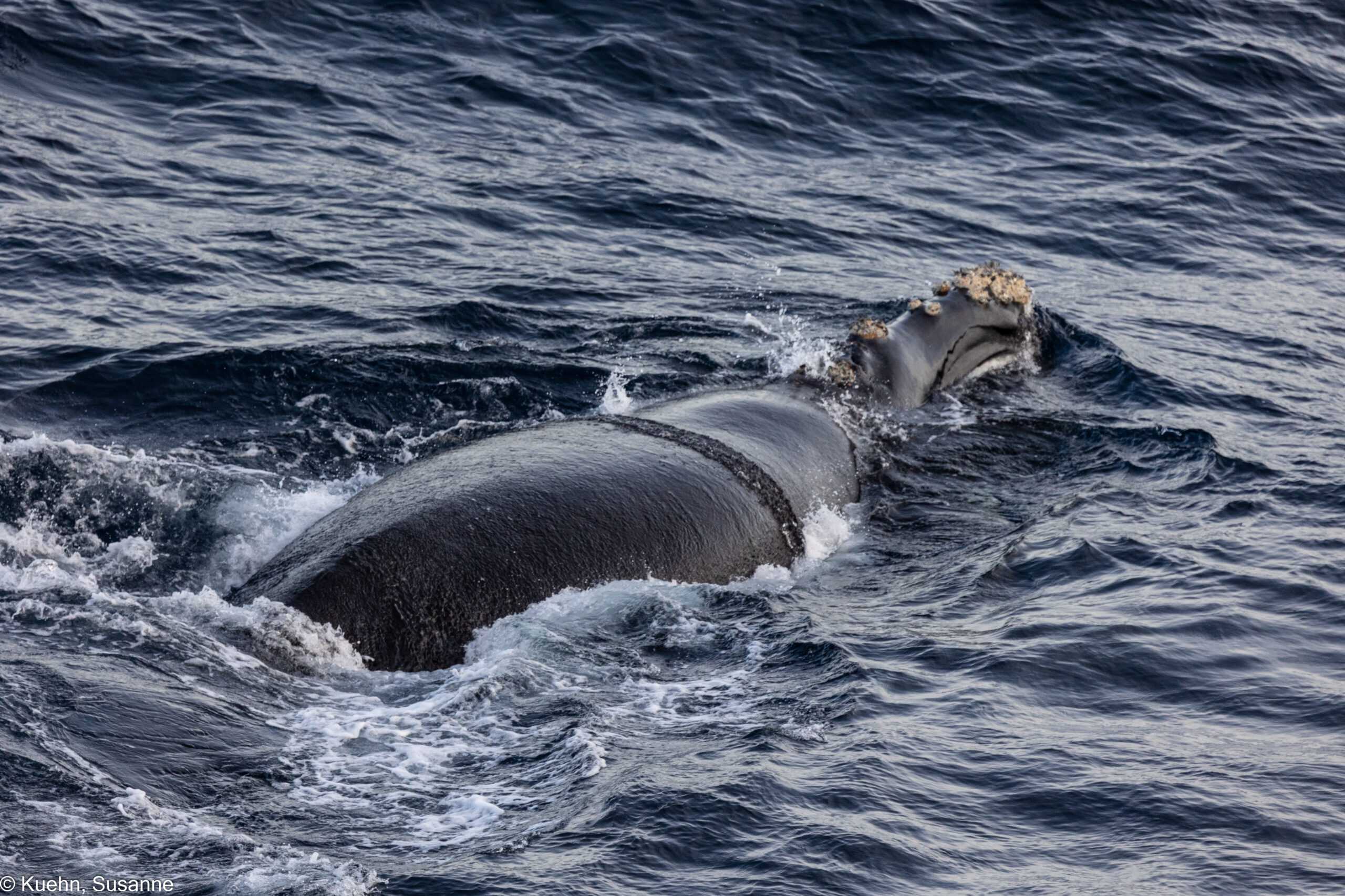
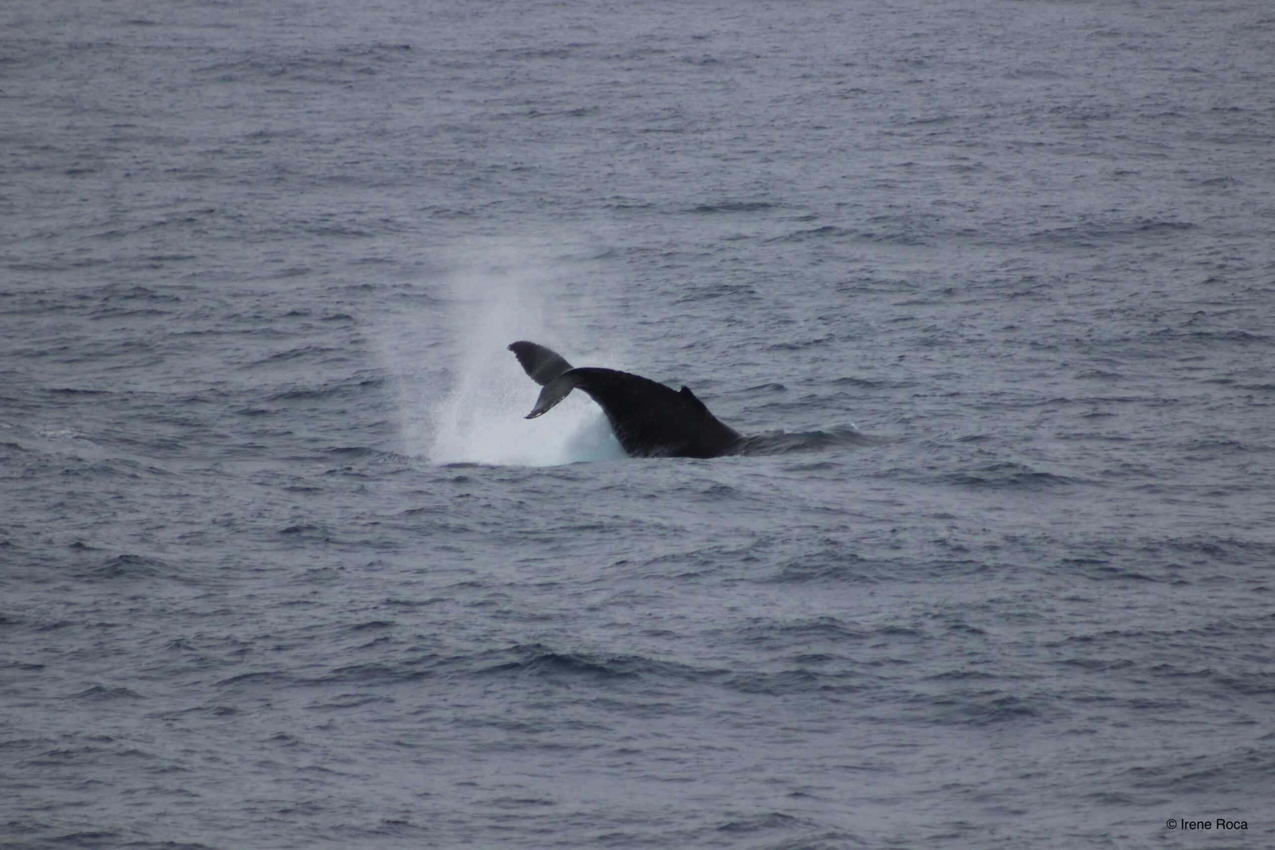
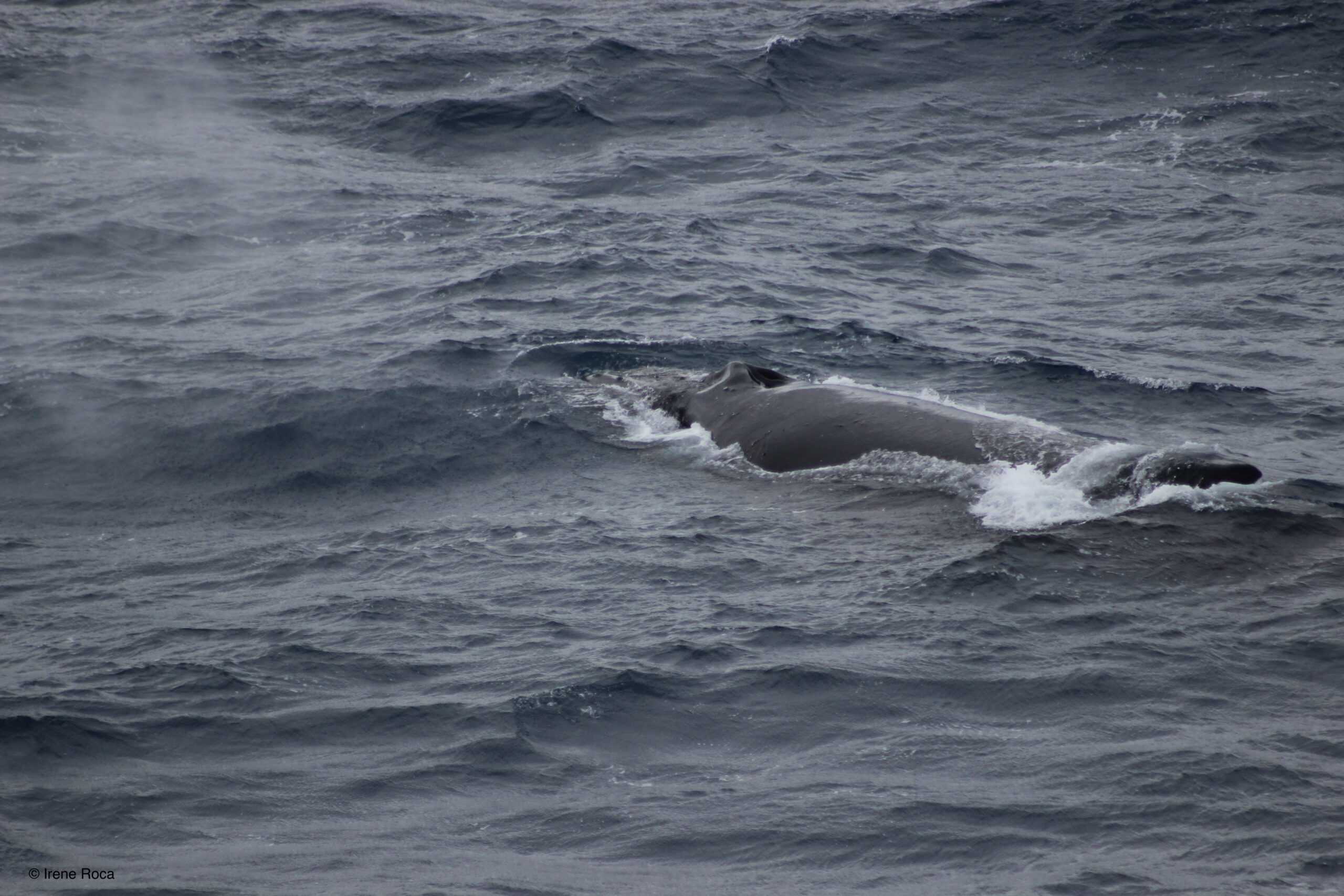
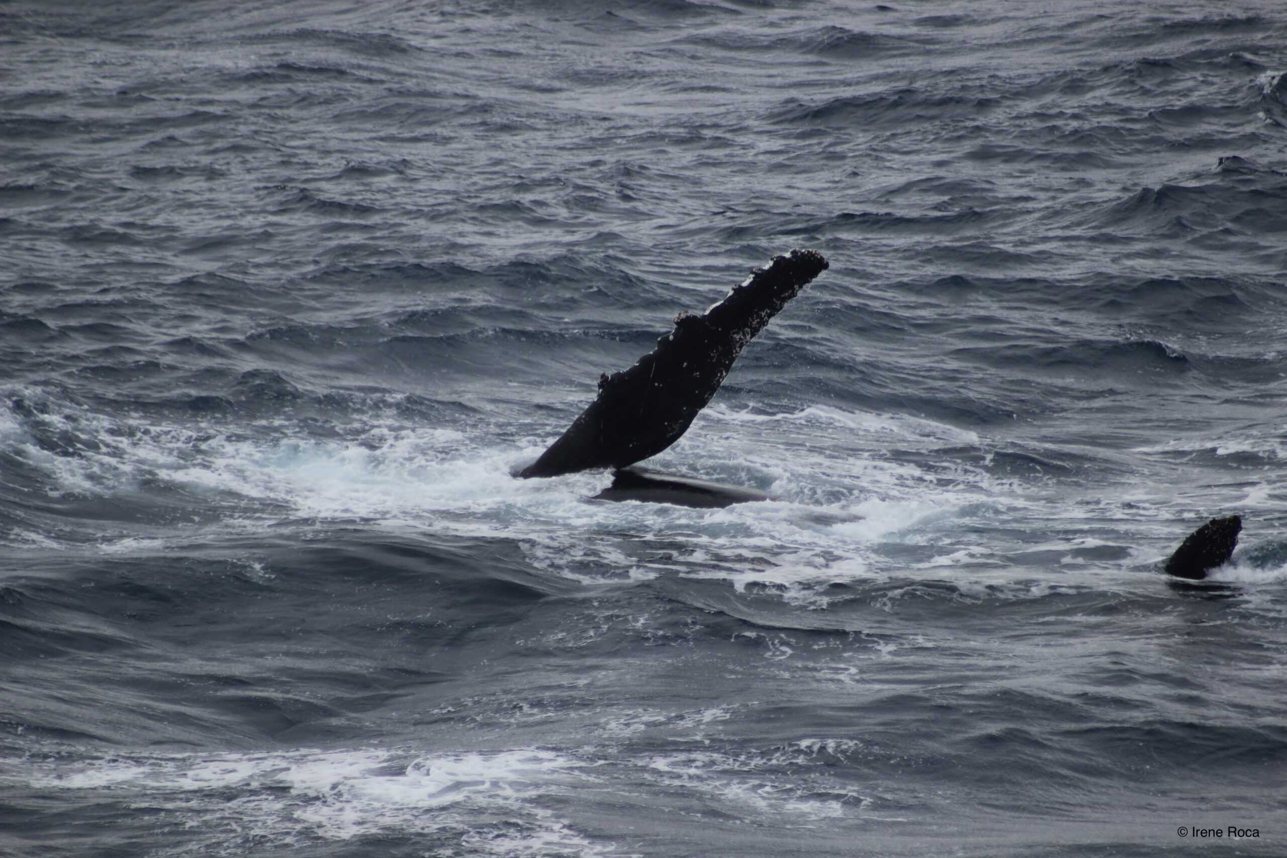
Today, at around 44° latitude we have passed the subtropical front AND at about the same time I have seen my first whale on this expedition, a beautiful Southern right whale. The animal must have been resting, likely unaware of the ship’s presence at first. It didn’t swim away from the ship and we had a very closed-up view. Right when the ship was passing by its side it probably woke up and started to swim more actively. It produced a short blow, showed its fluke to dive and disappear below the surface afterwards.
Luckily for us –who were watching the scene stupefied– expert bird watcher Susanne Kühn, was standing at her watching post on the higher deck of the ship. She swiftly aimed her zoom lens towards the whale and succeeded at capturing the sighting with her camera. Susanne and Bram Feij, collaborate in a research project from Wageningen Marine Research.
Their work at sea during the present expedition includes the development of top predator censuses. As long as the day light lasts, the two scientists will survey the ocean waters and assess sea bird and marine mammal densities.
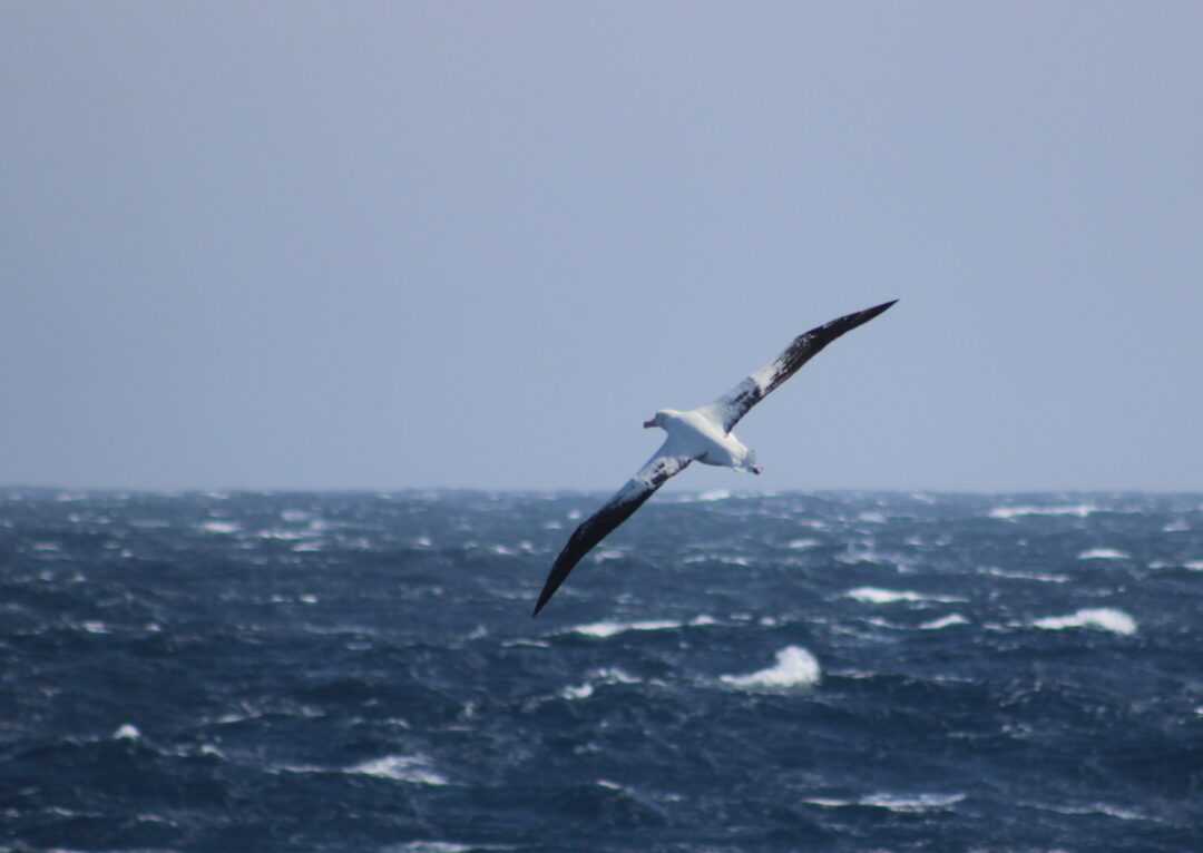
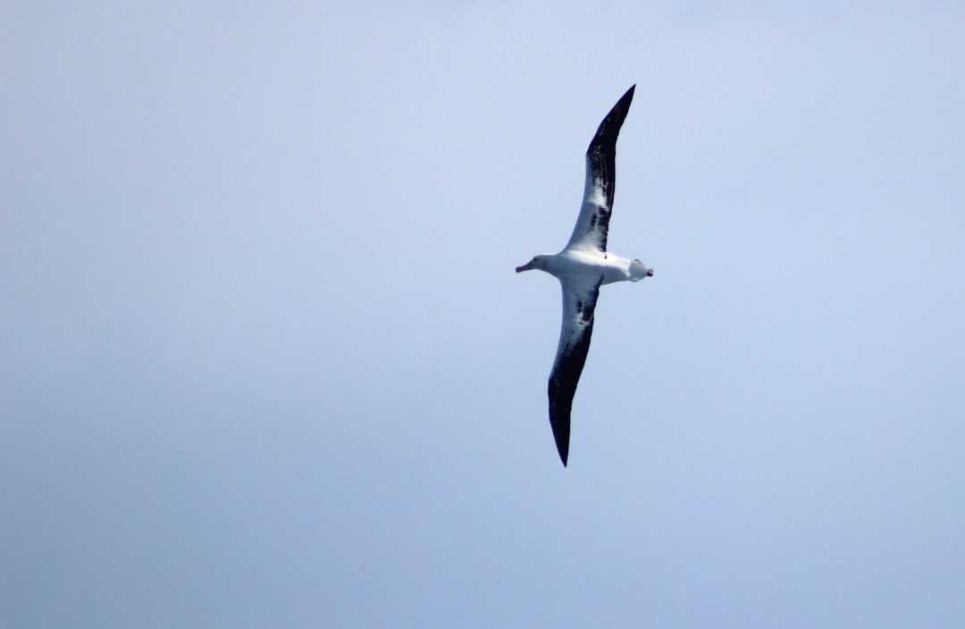
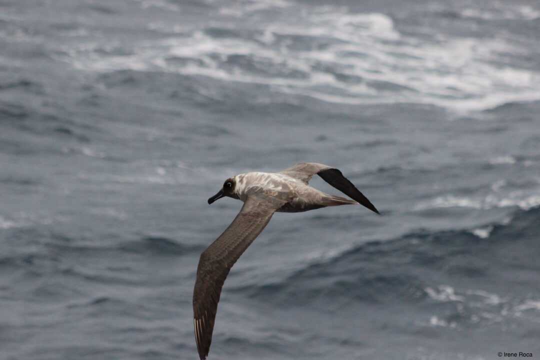
So far, I have had the chance to observe by myself a modest but very interesting list of species: Cape fur seals, soft-plumaged petrels, white-chined petrels, great-winged petrels, Antarctic prions, light-matled albatrosses, wandering albatrosses (their average wingspan is 3m, the longest of any living bird), and one Southern right whale. I’m looking forward to discover what other marine wildlife will I have the chance to see during PS129.

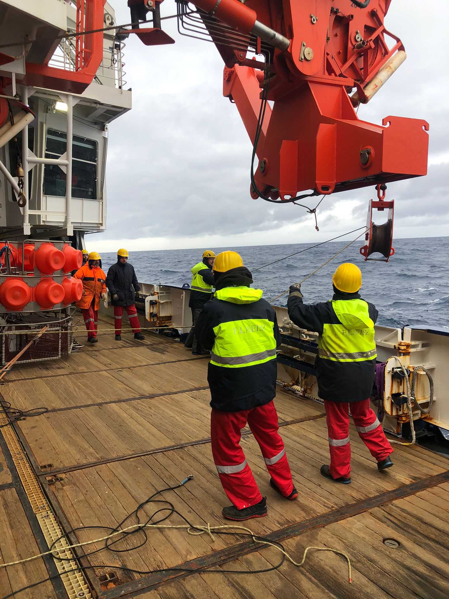
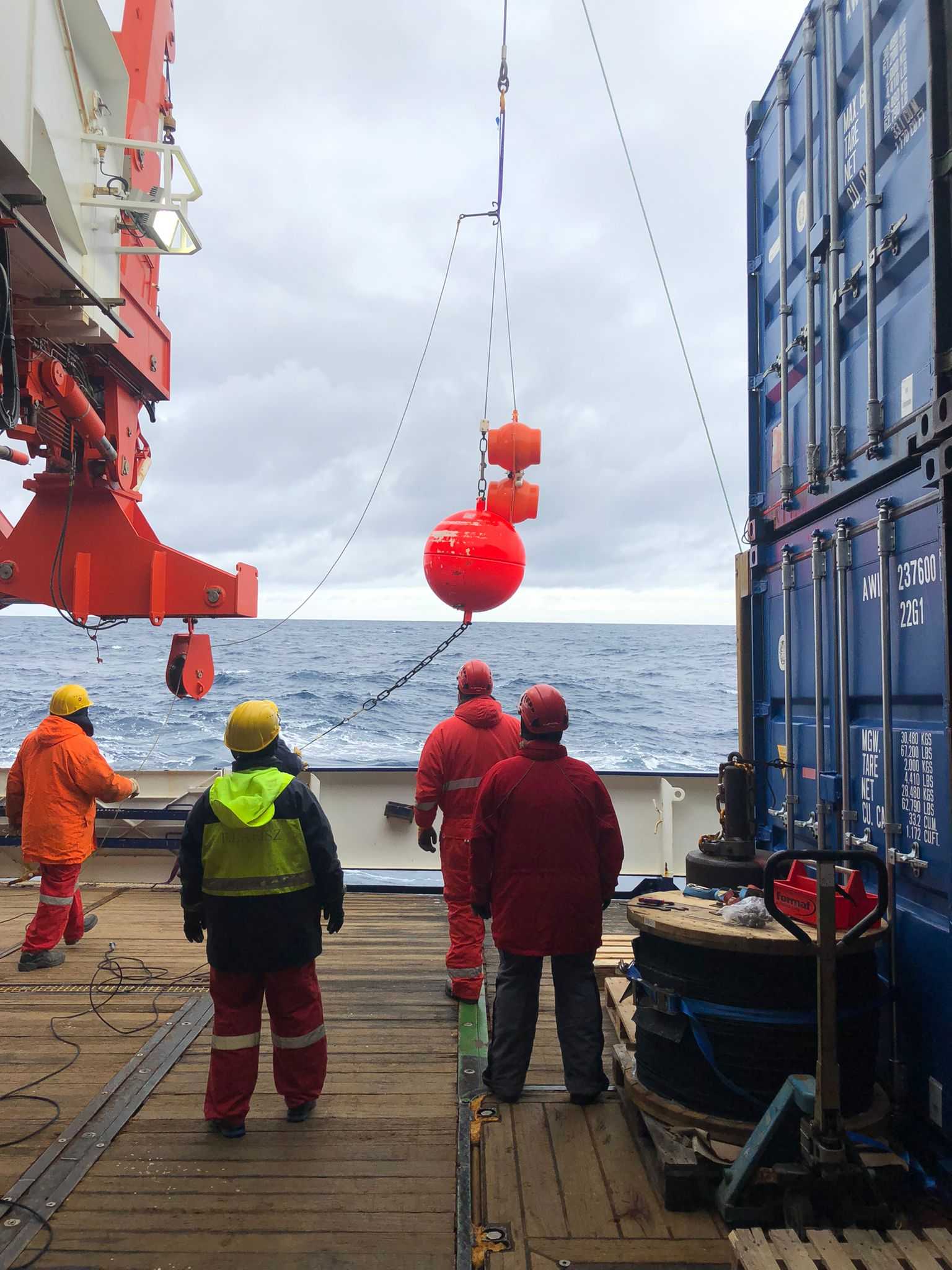
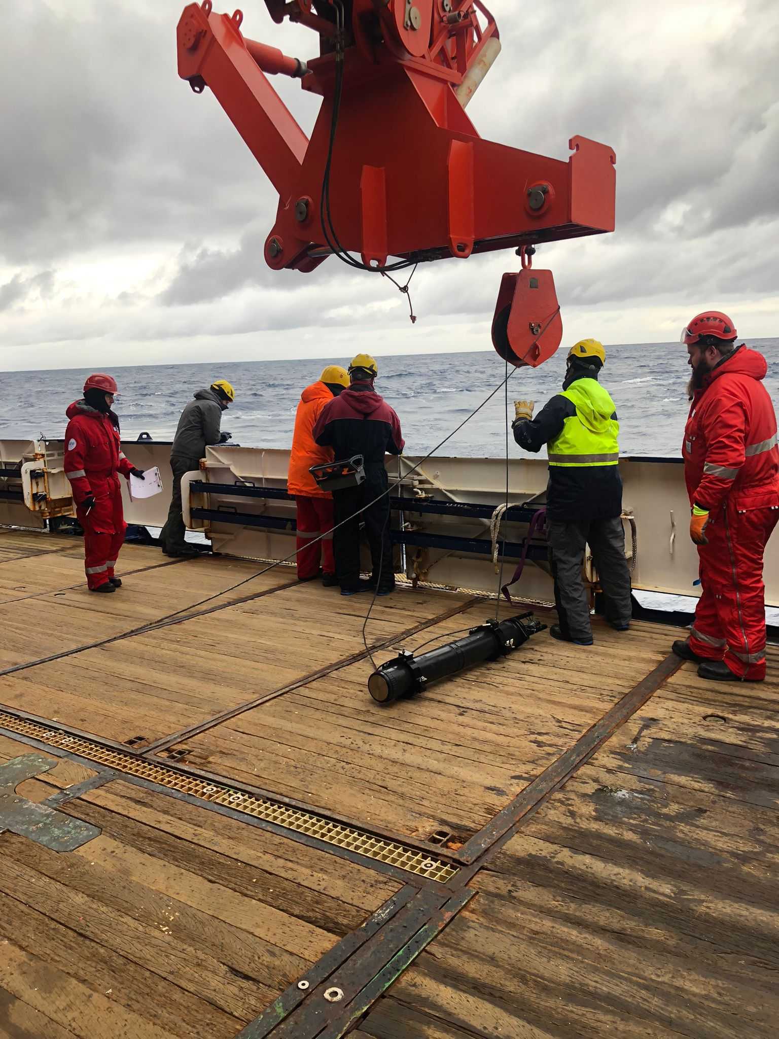
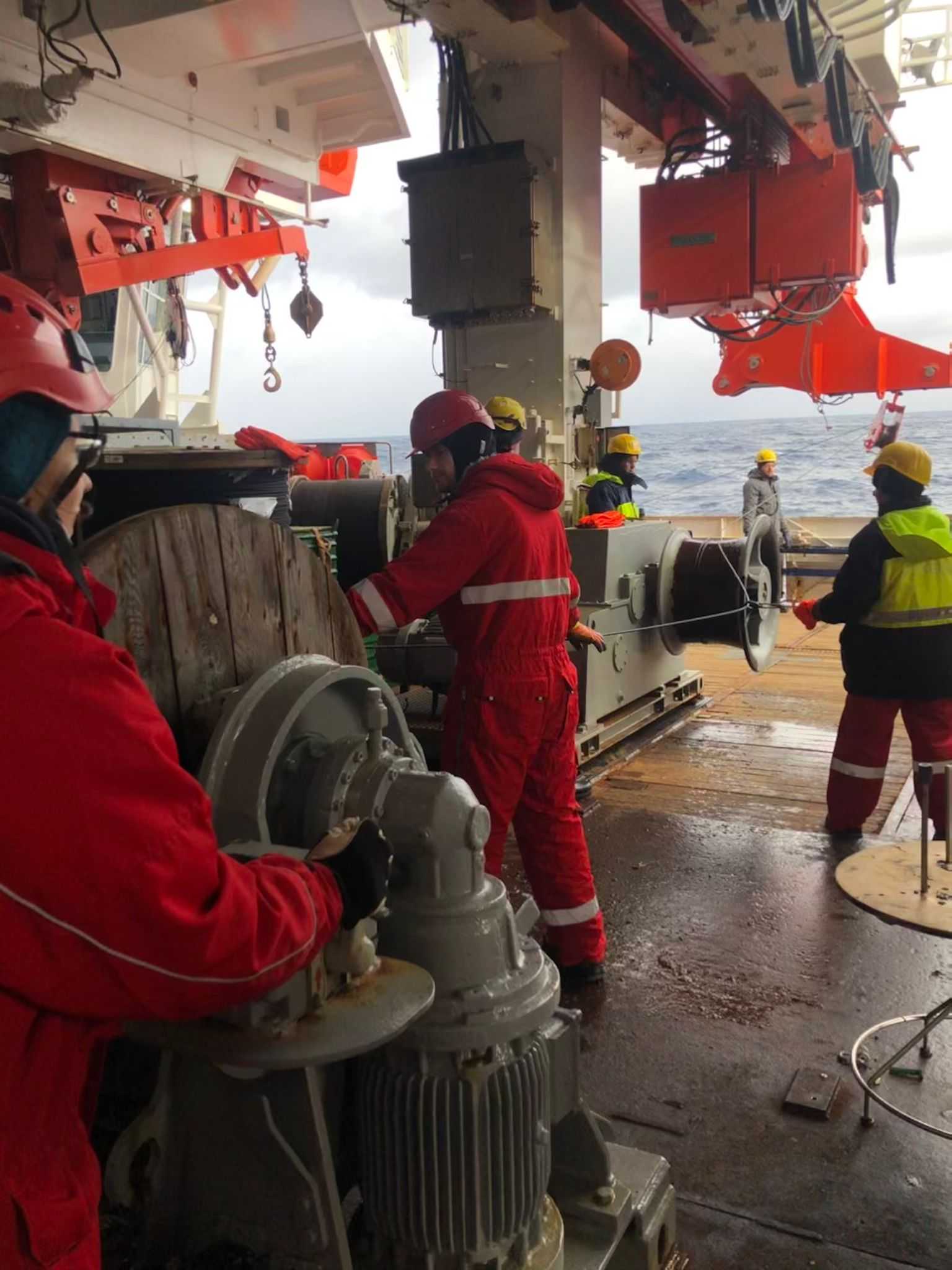
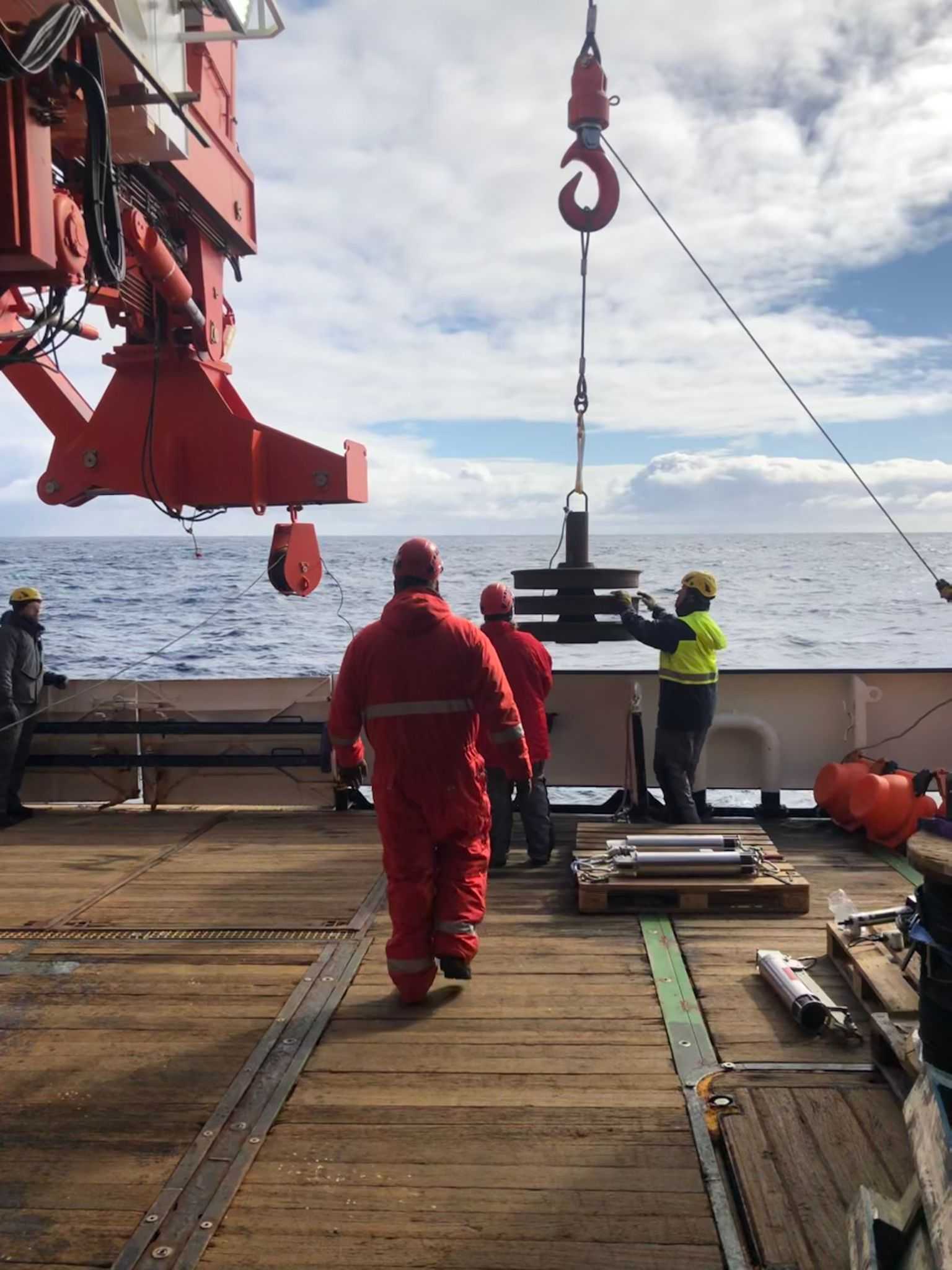
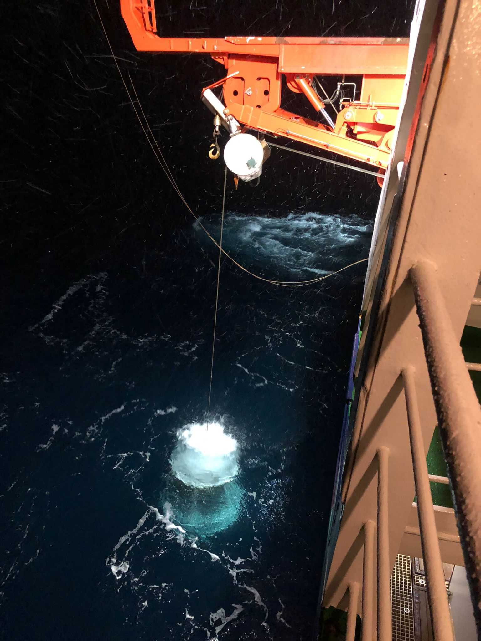
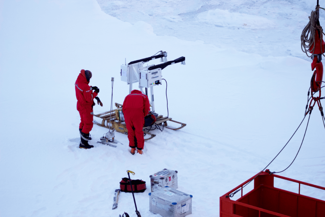
Since 2008 the Hybrid Antarctic Float Observing System (HAFOS) has been deploying a set of deep-sea moorings throughout the Weddell Gyre in an effort to overcome the observational constraints posed by high latitudes and the deep ocean. A HAFOS deep-sea mooring consists of a rope up to several thousand meters long, extending from the sea floor –where it is attached to an anchor weight– to some 200m below the sea surface –where it is attached to floatation elements that keep it upright throughout the water column. Distributed along this rope different oceanographic instruments, along with passive acoustic recorders (hydrophones), are attached.
The main goal of this deployment is to obtain Weddell-basin-wide time series of water mass properties throughout the deep and the surface layers, as well as of the composition of the acoustic environment, including biotic and abiotic acoustic sources (e.g., whales, seals, ice, ship engines). For this purpose, during our current expedition, 19 moorings featuring current meters, temperature and salinity sensors, sound sources and acoustic recorders will be recovered and redeployed.
Today we successfully recovered the first mooring. This mooring was anchored with a 900 kg weight 4600 m deep and had attached temperature and salinity sensors together with a passive acoustic recorder.
Normally, the mooring is freed from its weight through a remote acoustic release and pops up on the water surface where it’s floats become visible and can alert the ship of its exact position. The complete recovery procedure can last about 4 hours. However, if the release fails and the mooring is not automatically heaved, a small robot (a remotely operated underwater vehicle – ROV) could be launched and remotely controlled to hook the rope and free the mooring. After recovery a new mooring with new instruments is deployed from the ship at the same position. These instruments will record oceanographic and ecological data during 2-3 years before the mooring is recovered in turn.
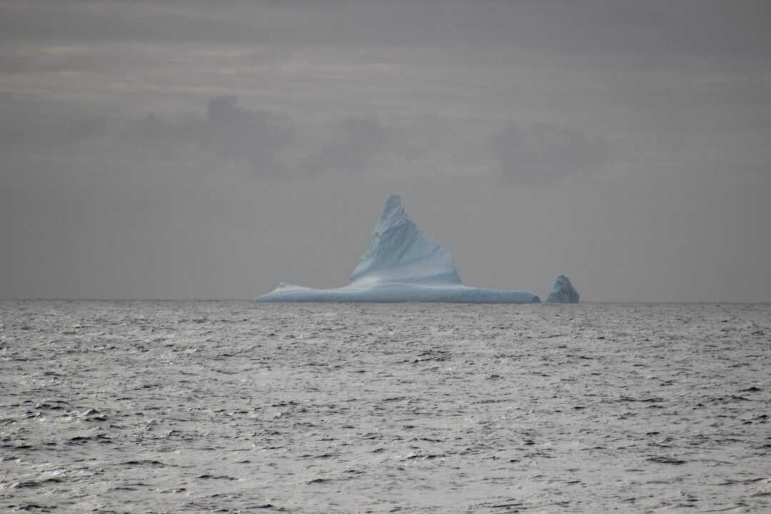
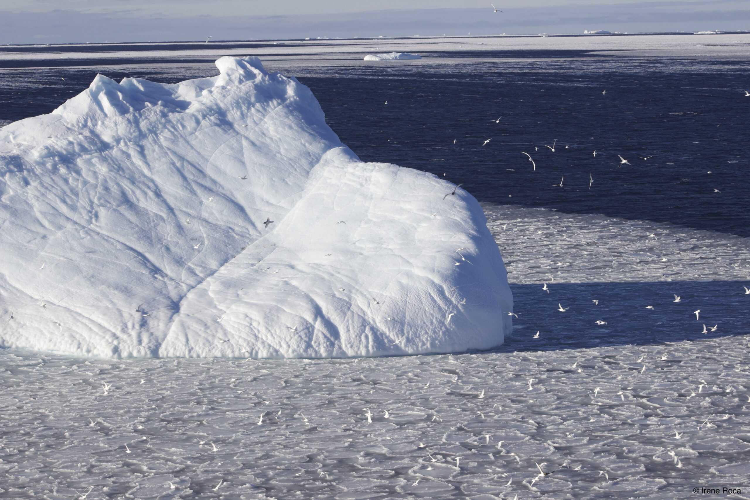
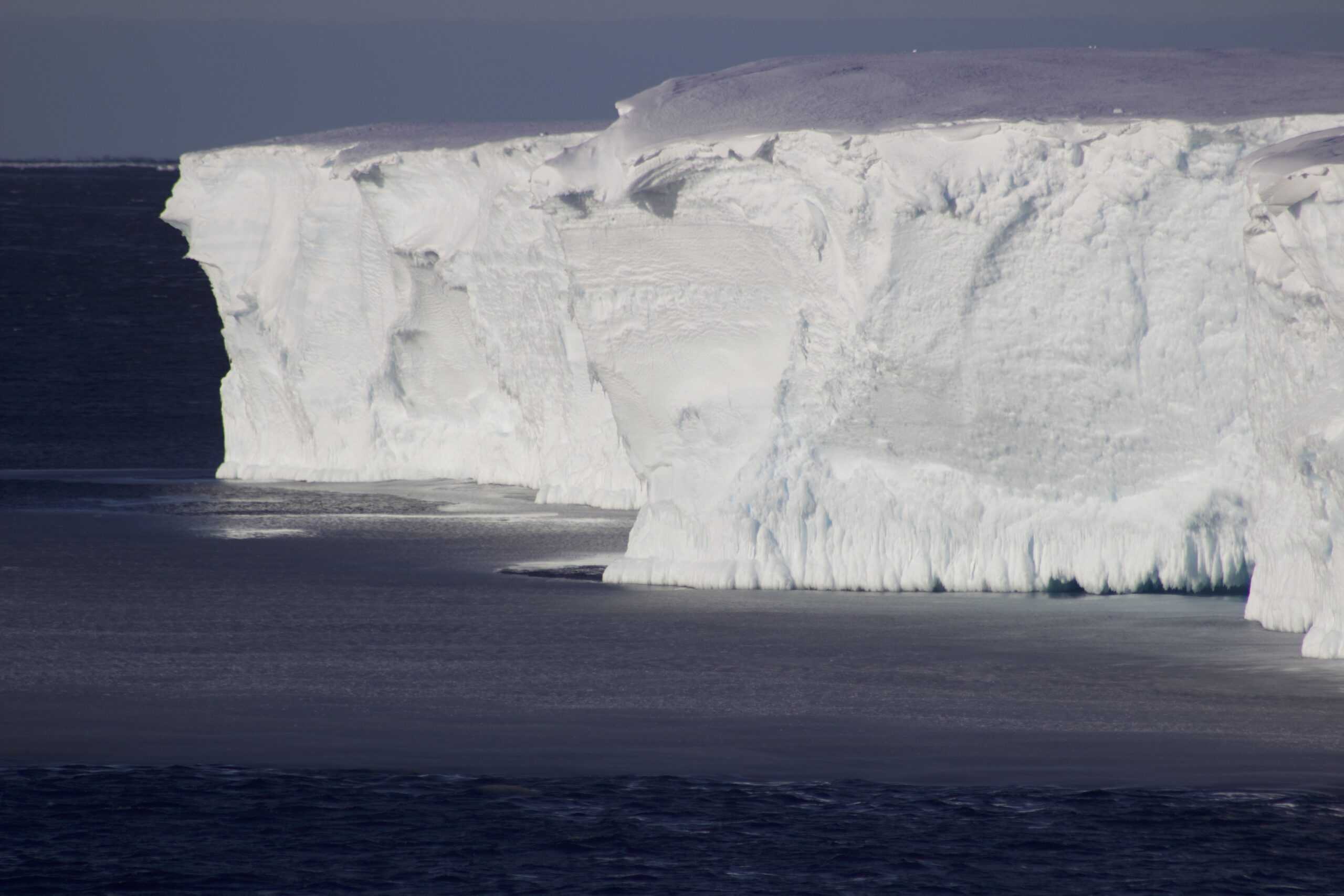
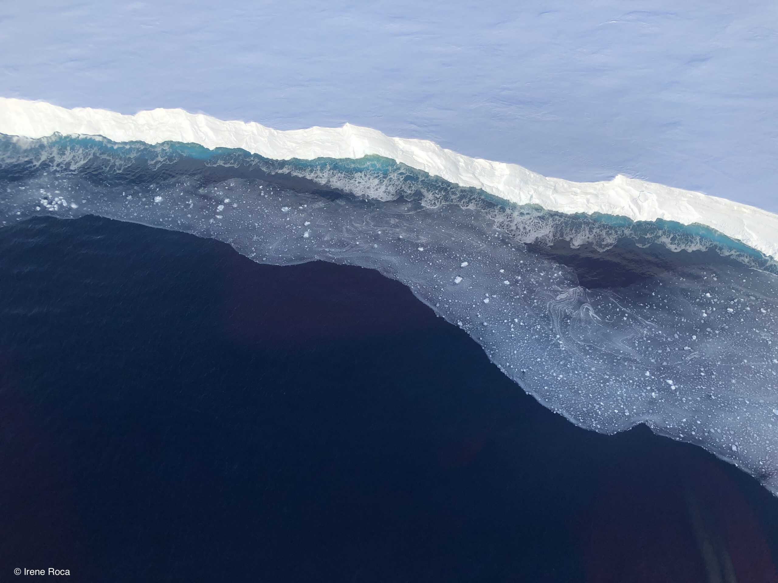
Today we have crossed the 60° latitude and therefore, we have officially reached the Antarctic region. As a fair warning, air temperature has dropped in the past days and with the wind-chill the temperature on deck varies from -5 to -9ºC. However, the most exciting indicators of our approach to the Southern Ocean and the Antarctic ice shelfs are the first icebergs! With only one-tenth of their volume above water, each iceberg has a very specific size, shape and watermark, all of which tells the story of their journey adrift ocean waters. Many of these icebergs that we are finding at this latitude on our way South, are most likely drifting carried away by the Antarctic Circumpolar Current (ACC).
The ACC is an ocean current that flows clockwise from west to east around Antarctica at around 60° latitude. Propelled by currents and winds, icebergs broken off the ice shelfs in the Weddell Sea basin gather in the Antarctic peninsula coastline and are slowly driven away by the ACC into the Southern Atlantic Ocean and beyond.
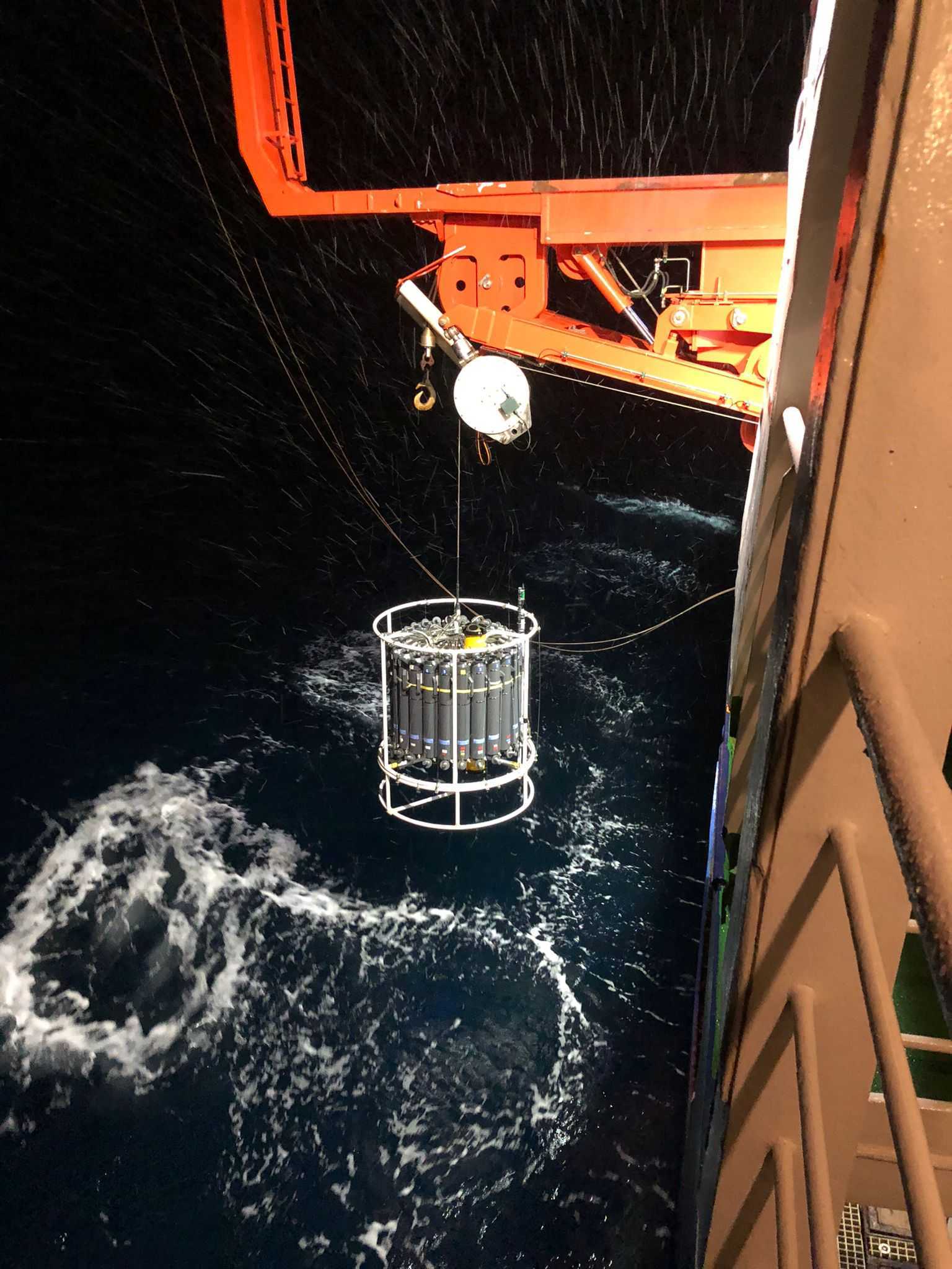
One of the most exerted sampling devices in PS129 is the CTD-rosette.
CTD stands for conductivity, temperature, and depth. A CTD logger comprises a combination of electronic devices used to detect how the conductivity and temperature of water changes relative to depth. The CTD can be incorporated into an array of empty bottles, referred as rosette, and coupled with additional sensors measuring other parameters like oxygen saturation and current velocity. On board, we use a CTD-rosette comprising 24 12L bottles.
The ensemble –CTD-rosette– is lowered into the water column using a winch and a crane until the desired depth. In its way up, the sampling bottles, now filled with water, are closed at predefined depths triggered through the computer. In our first stations following the prime meridian, we have been sampling at 4-5km of water depth. In such depths the entire process takes approximately 4 hours to be completed.
As part of the HAFOS team, my colleagues and I are in charge of the CTD-rosette. Following a carefully planned watch system, and with the invaluable help of the crew, we operate the device day and/or night.
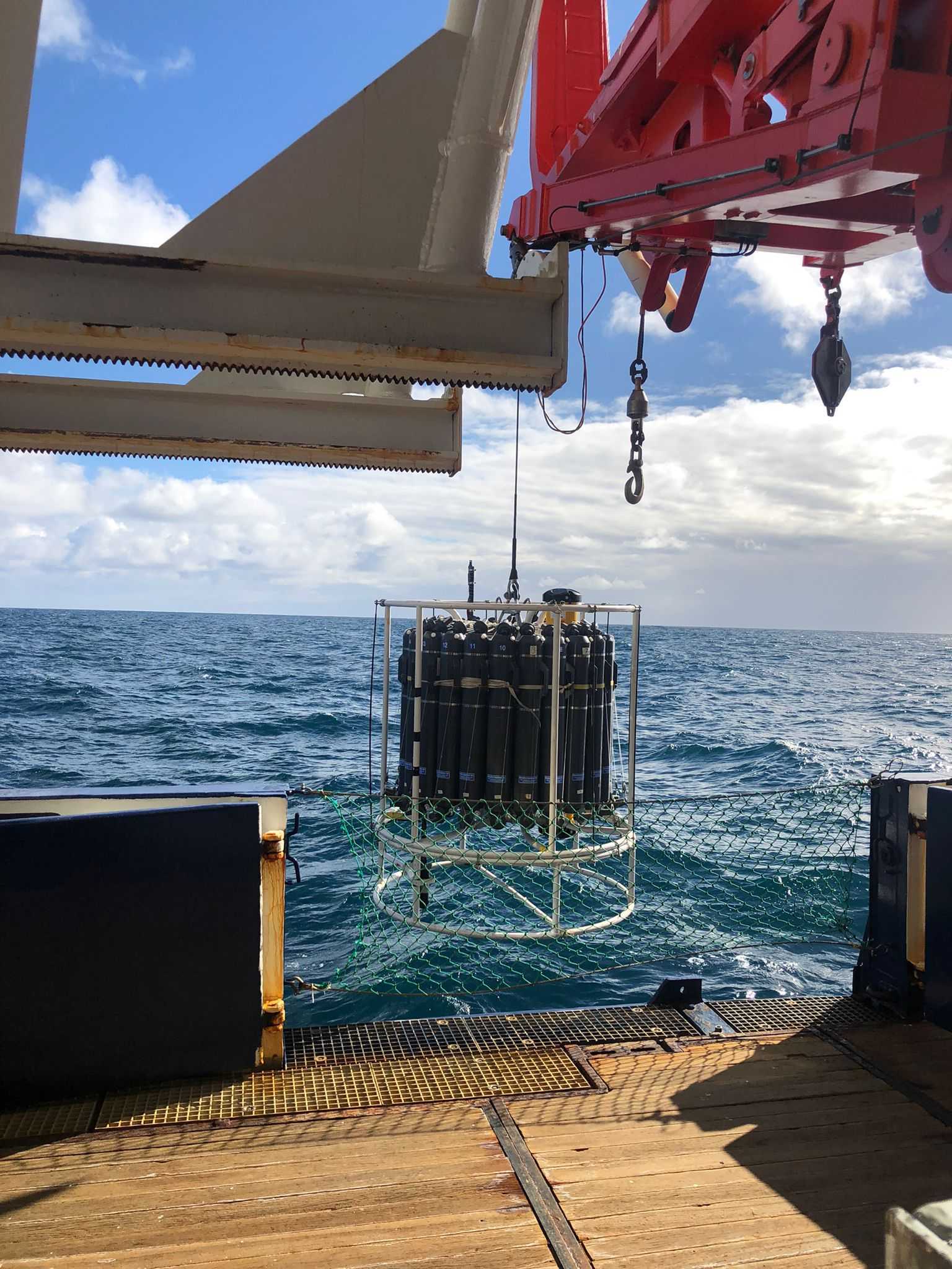
Once the CTD-rosette is on deck, the water samples are subsequently analyzed for biological and chemical parameters. In our expedition, researchers will use the water for a great variety of purposes. For example, to determine the available inorganic nutrients in the water column (e.g., nitrates, ammonium, silicate and phosphate). These nutrients drive productivity and trophic dynamics and are also well suited as tracers for the identification of water masses. Another use that will be given to the sampled water is to analyze the carbon dioxide, to measure the amount of anthropogenic carbon being incorporated by the different water masses, it’s concentration in deep and bottom layers and its storage and evolution in the sampled area.
Chlorophyll and other pigments will be also filtered from the samples taken from the upper layers of the water column to study phytoplankton diversity and productivity.
Yesterday was a wonderful day! It started with a lovely note that the stewardess and nurse on board, Romy Ilk, who also takes care of the rooms, left at ours: “You are not a drop in the ocean. You are the entire ocean in a drop :)”
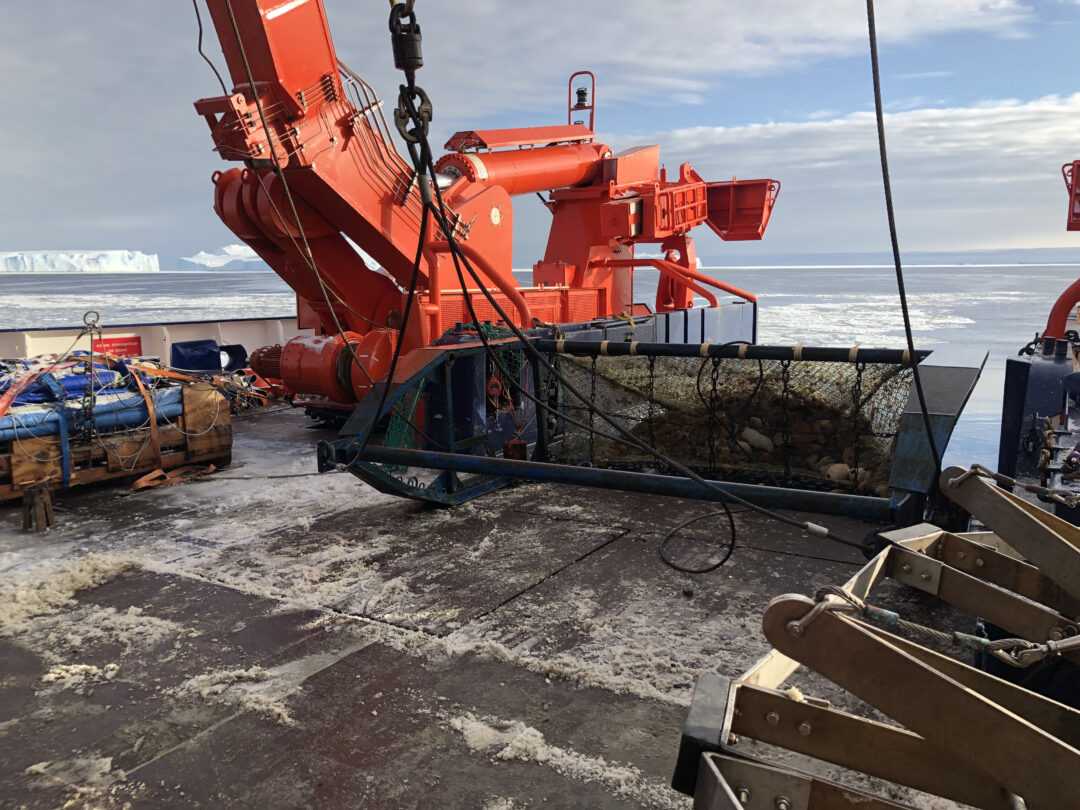
We also reached the last station that we will sample from the prime meridian transect. From now on, we will continue southwest, first towards the Neumayer-Station III and Kapp Norvegia to continue west through the Weddell Sea next. In yesterday’s station, among other things, we did a CTD-rosette cast, recovered and deployed moorings, we launched a couple of floats and calibrated a sound source for later deployment. The EWOS team (Eastern Weddell Sea observatory system) also deployed several fishing devices –a Surface and Under-Ice Trawl (SUIT) and a Multiple opening Rectangular Midwater Trawl (M-RMT)– to sample zooplankton and small pelagic fish.
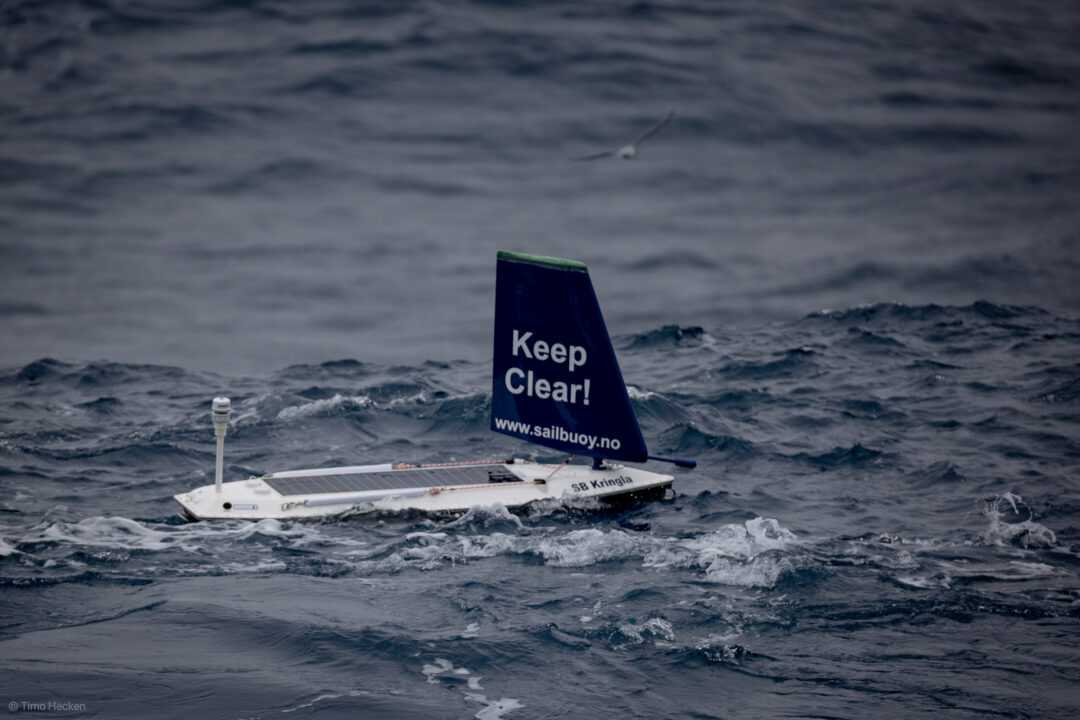
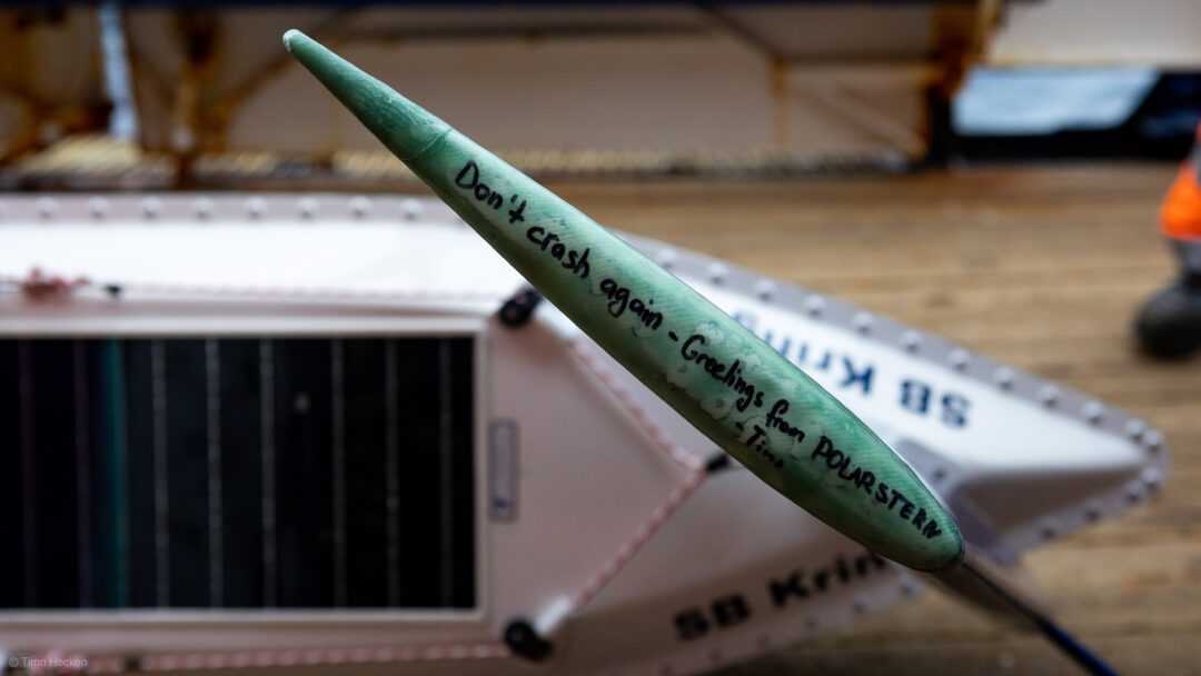
In addition, we launched the sailbuoy “Kringla” from Gothenburg University. A couple of days ago we recovered this sailbuoy which had been drifting in the Southern Ocean waters. The buoy regularly measures water temperature, salinity and current velocity, as well as air temperature, pressure and wind speed. It converged with the Polarstern at the exact position of our station for recovery.
We downloaded the stored high-resolution data and release the buoy some days later into the water for it to continue its sailing journey. Timo Hecken, helicopter technician on board, repaired its slightly damaged sail before the launch.
Currently, Kringla is steadily sailing North towards lower latitudes where it will stay until July when the Gothenburg team will pick it up or sail it to Cape Town for recovery.
Last but not least, all this activity on board was carefully surveyed from the water. During the last three days we have been accompanied by several Humpback whales that curiously approached and swam around the ship.
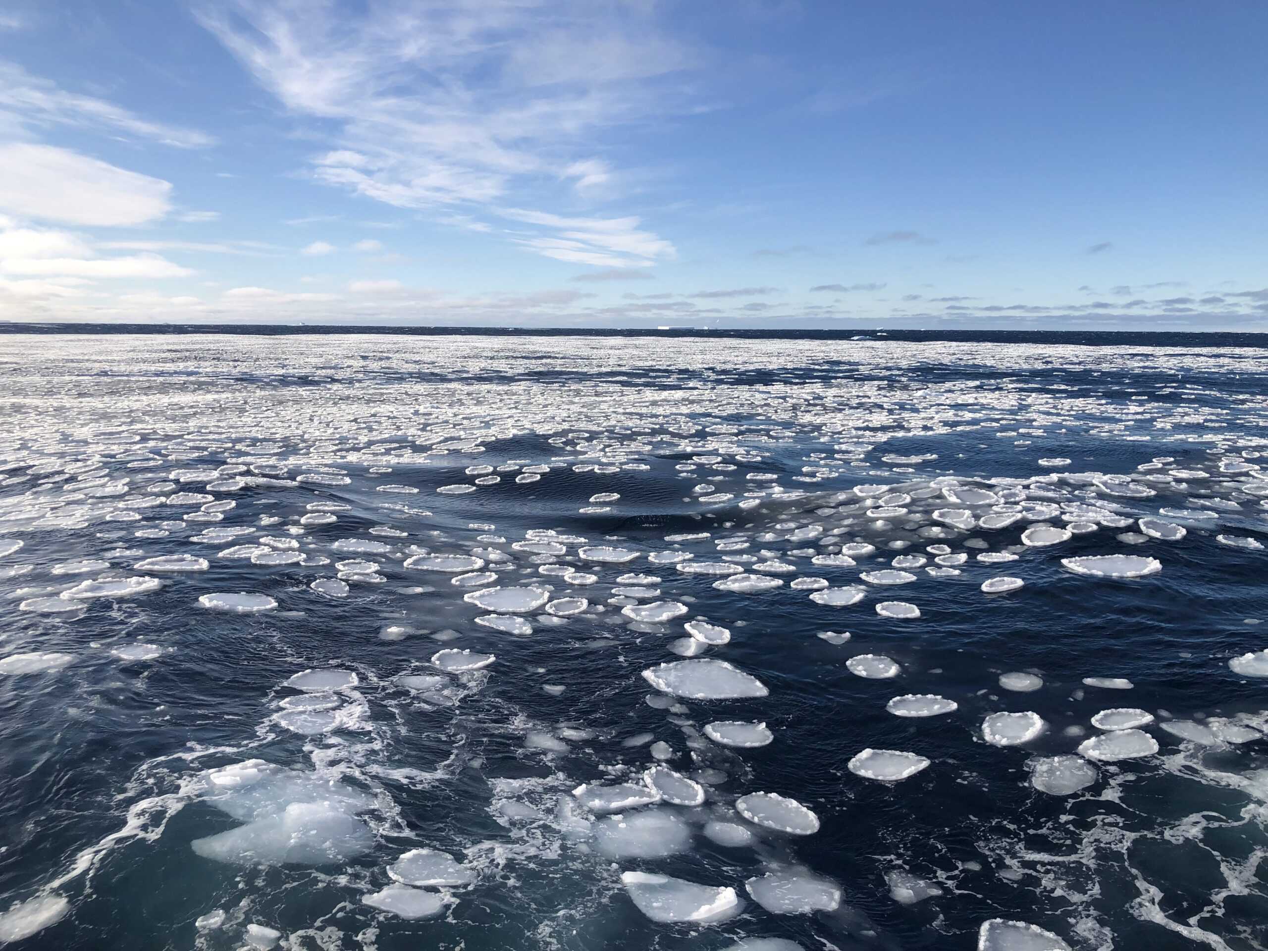
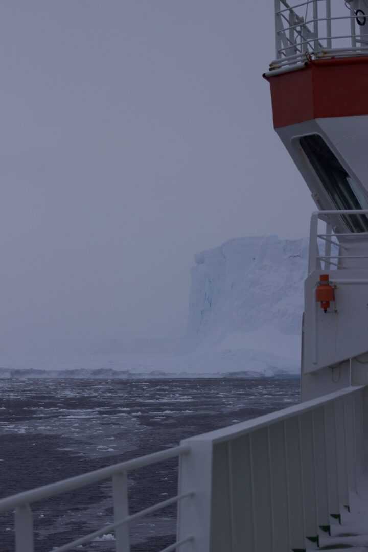
Today we have arrived to Antarctica! We have been steaming all day to arrive in the late afternoon to the edge of the Ekström Ice Shelf, 20km away from the Neumayer-Station III. The change in the weather and the seascape has been abrupt however. Suddenly, the lower decks of the Polarstern were frozen and terribly slippery. Air temperature dropped to -15ºC, with -30ºC of wind chill temperature. Bigger icebergs crowded around the ship, sea ice started to materialize in the horizon and shortly afterwards we were sailing through pancake ice. All suited up in our polar clothes scientist and crew gathered outside on deck to witness the spectacle and anticipate the arrival in front of the imposing ice shelfs.

Flocks of beautiful white snow petrels have appeared and hovered around the ship seemingly enjoying the strong and cold southerly wind. Also, Antarctic and Southern giant petrels have accompanied the ship in its way towards the continent, as well as a group of 4 Antarctic minke whales that hurried alongside the ship diving between thin sea-ice patches.
Tonight, we navigate again with the intention to arrive tomorrow morning to our next sampling station.
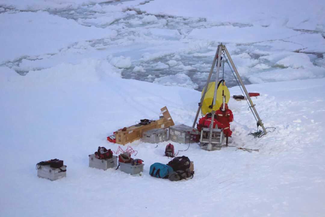
The Perennial Acoustic Observatory in the Antarctic Ocean (PALAOA) is situated on the edge of the Eckström Ice shelf in the eastern Weddell Sea, roughly 30km away from Neumayer-Station III.
At this location, an aluminum box is buried under the icy surface of the floating ice shelf containing two rechargable batteries and an acoustic recorder. By means of a cable pierced through the thick (~160m) ice shelf, the recorder is connected to a hydrophone which is suspended in the water column beneath the shelf and well above the seafloor. Thus installed, the recorder records continuously year-round soundscapes off PALAOA, even throughout the darkness of the polar winter. In this fashion, it is also accessible by the Neumayer overwintering team for battery replacement and data retrieval.
However, in its lost battle against gravity, the flowing ice-shelf advances inexorably towards the ocean water where the ice on its verges ends up melting or calves off the shelf. This slow but steady advancement entails that the stations need to be closely monitored and repositioned every 3 to 5 years.
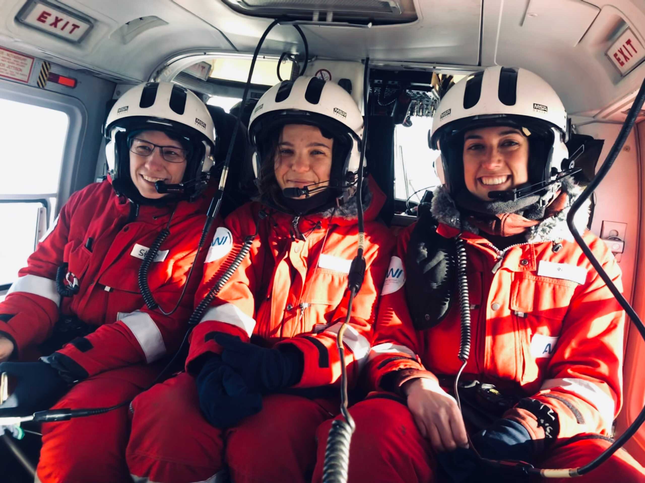
Today, together with two HAFOS colleagues, I flew over the Antarctic ice-shelf on the helicopter to PALAOA. Our goal was to check up the advancement of the station and retrieve the acoustic data.
Unfortunately, the hydrophone and a good part of the cable where already broken off the ice shelf. However, we were able to locate the box with the recorder, dig it up (after 40 min of snow and ice shoveling) and recover the recorder unit and the data.

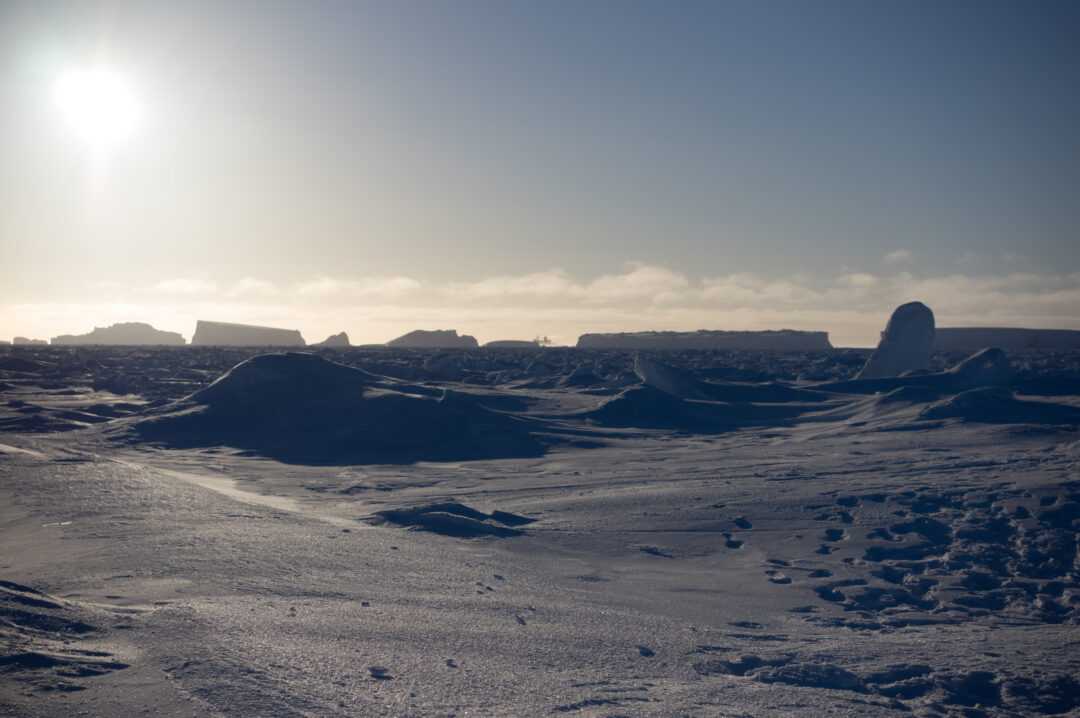
Warmed up by the exercise despite the -20ºC wind chill temperature, we were able to briefly enjoy the experience of stepping in the Antarctic continent and the amazing view of the polar desert landscape before we were picked up again by the helicopter and securely flown back to the ship.
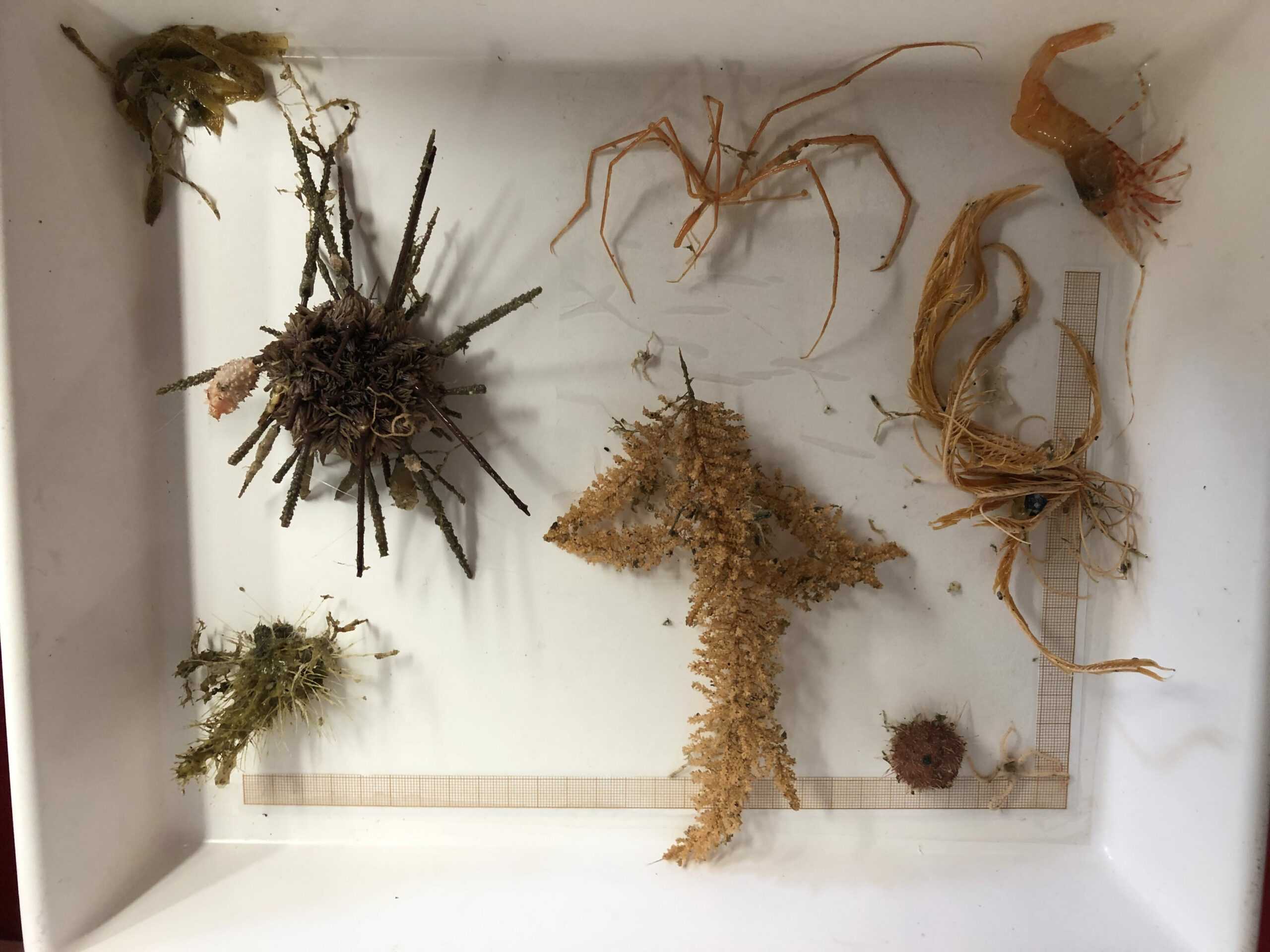
On board of the Polarstern and during the current expedition, the Ocean Floor Observation and Bathymetry System (OFOBS) team will investigate Weddell Sea’s seafloor habitats and their associated epibenthic megafauna using a non-invasive approach.
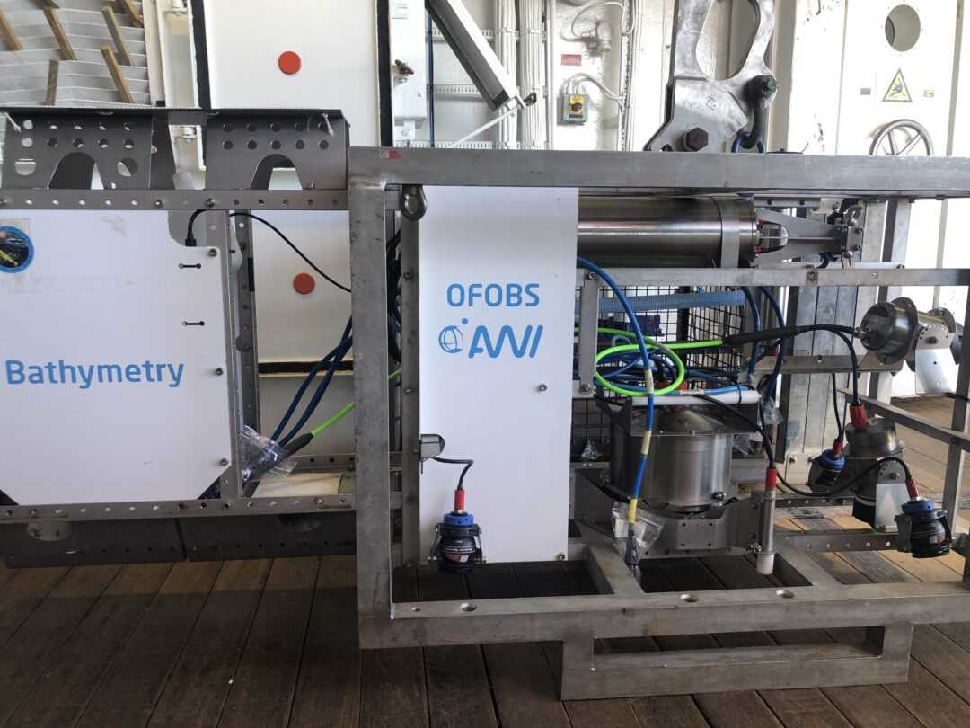
OFOBS is a towed device that can be deployed in moderately ice-covered regions and is capable of concurrently collect acoustic, video and still image data from the seafloor down to 6000m deep. Through the compilation of these data, the OFOBS team aims to map the seafloor at specific locations, describe the biodiversity, abundance and biomass of megabenthic communities and assess temporal changes in habitats and communities through comparison with surveys dating back to the 1980’s.
So far, OFOBS sampling has been very successful and has allowed everyone on board to be privileged witnesses of the amazing and beautiful life-compositions of the Southern Ocean’s seafloor, which depth and darkness makes them otherwise unreachable for the human eye.


From small white nudibranchs to large colored sponges, through different forms of burrowing and polychaete worms, sea stars and urchins, crinoids and ophiuroids, vivid red decapods, sea spiders, bryozoans, benthic corals, cephalopods and fish, each image constitutes a stunning portrait. I sincerely hope that next generations, including my little daughter, will still have the chance to coexist with these wonderful forms of wildlife.
The diversity of terrestrial wildlife in Antarctica is very limited, there are very few species that can survive Antarctica’s icy deserts with their extremely low temperatures, high solar radiation, and extreme dryness. However, the oceans themselves are a more stable environment for life, both in the water column and on the seabed. The benthic communities of the Antarctic seafloor are dense and diverse, considered to harbour between 50% and 80% of endemic species, many of which are scarcely studied or even unknown.
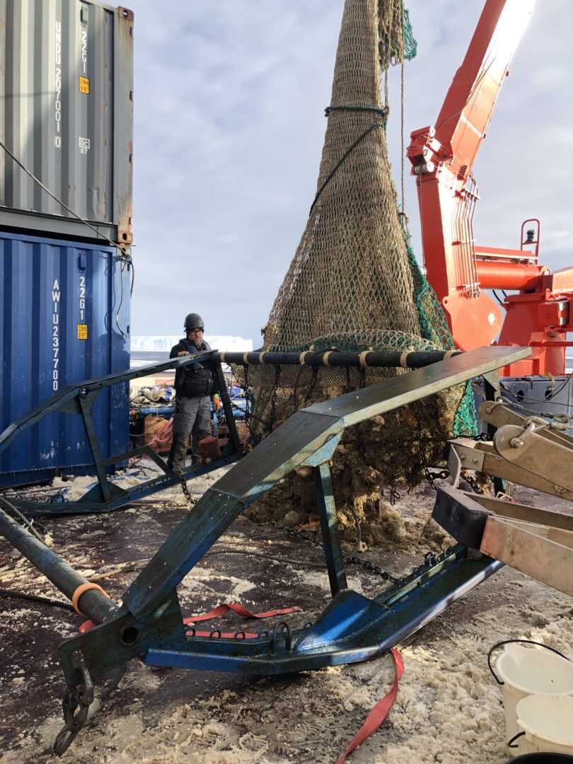
In this context, part of the Eastern Weddell Sea observatory system (EWOS) team on board aims to study the biodiversity of benthic fauna on the continental shelf and the shelf break, as well as the resilience, adaptation and acclimation capacities of these organisms to face strong habitat and environmental fluctuations. In order to fulfill this goal, the EWOS colleagues use remotely controlled devices, like ROVs and OFOBS, and a series of traps, trawls and long-lines to access whole organisms, tissue samples and DNA/RNA for subsequent ecophysiological and molecular analysis, some of which will be started on board and further carried on in home laboratories.

On board of Polarstern there is a meteorological office from the German Weather Service. Besides the weather station on the ship’s upper deck, every day before noon a weather ballon is released into the atmosphere from the helideck. The sensor attached to the balloon retransmits to the ship information about the air temperature, pressure, humidity and wind speed at the different altitudes it crosses in its ascent. The balloon is able to reach the stratosphere with a maximum height of approximately 35 km.
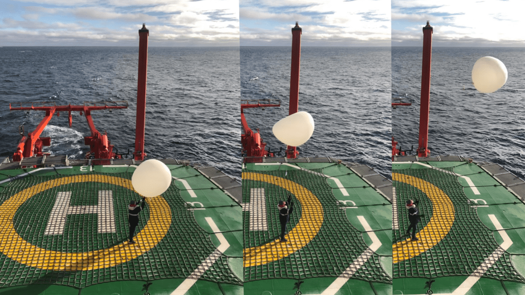
The weather scientists on board use this information, together with regular observations of the weather and ocean conditions during the day, to produce daily local weather reports to complete and validate weather models’ forecasts.
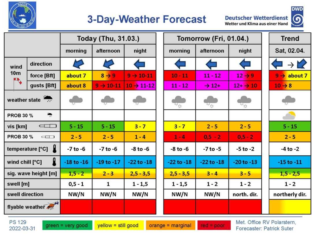
The weather forecast is crucial for the general planning on board. The ship position, course and speed, the scientist sampling schedule and the helicopter flights, all depend on it and are planned accordingly. So far, the weather conditions have been propitious during the expedition.
However, today we are trying to avoid the roughness of a powerful storm. Two low-pressure systems have merged close to our location and the sharp pressure gradient is causing very violent winds predicted to reach hurricane force (12 Bft) in the area. We have been forced to abandon our planned course and sampling schedule and seek refuge at an eastern and lower latitude position, in the so called “Iceberg graveyard”, were the grounded icebergs and the forming sea-ice may shelter the ship from the impending storm.
We weathered the storm well protected against the strong easterly winds behind the immense grounded icebergs within the iceberg graveyard. Now we head west to resume our expedition plan across the Weddell Sea. On board, we –the HAFOS team– and with the help of the crew are busy again with mooring recoveries and deployments, float launches and CTDs. In the meantime, scientist from the EWOS team analyze and prepare the samples that have been taken in the last two weeks from the seabed and water column close to the continental shelf.
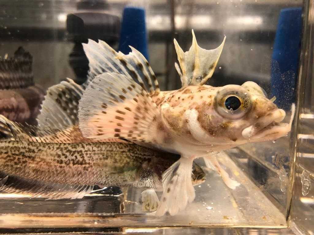
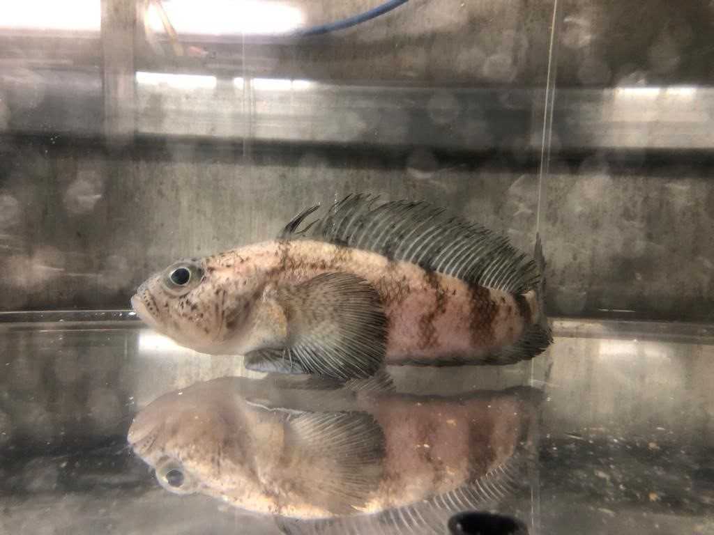
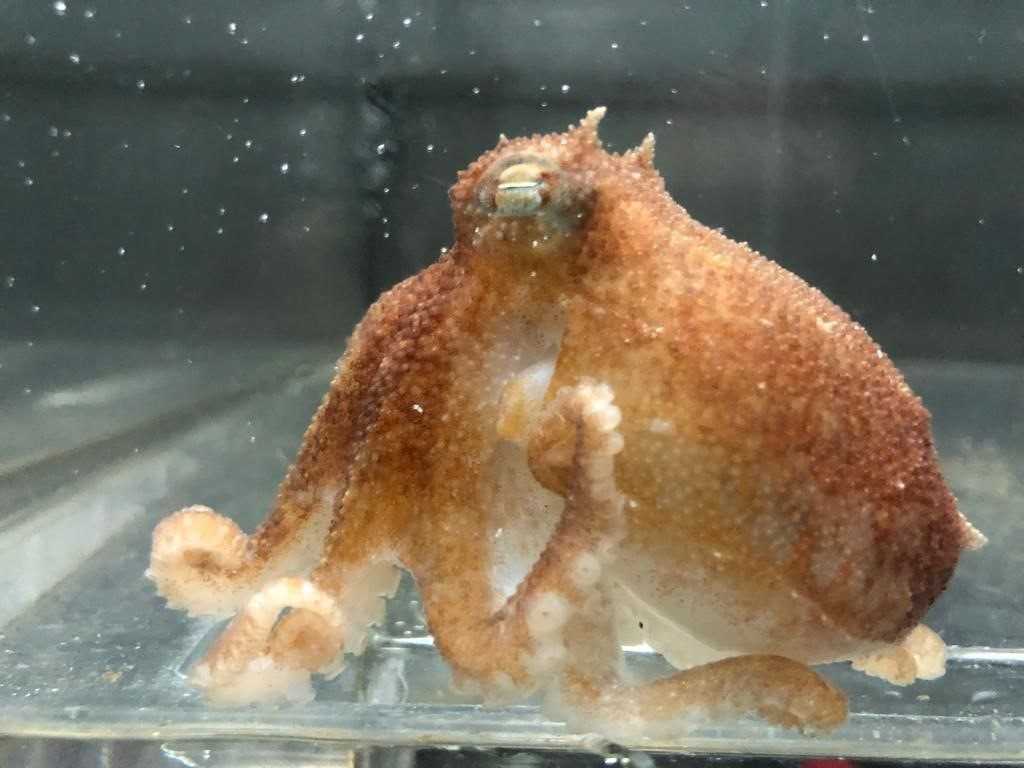
Specimens from some species of Antarctic demersal fish, chelicerates and benthic octopuses have been kept in aquaria on board for further study.
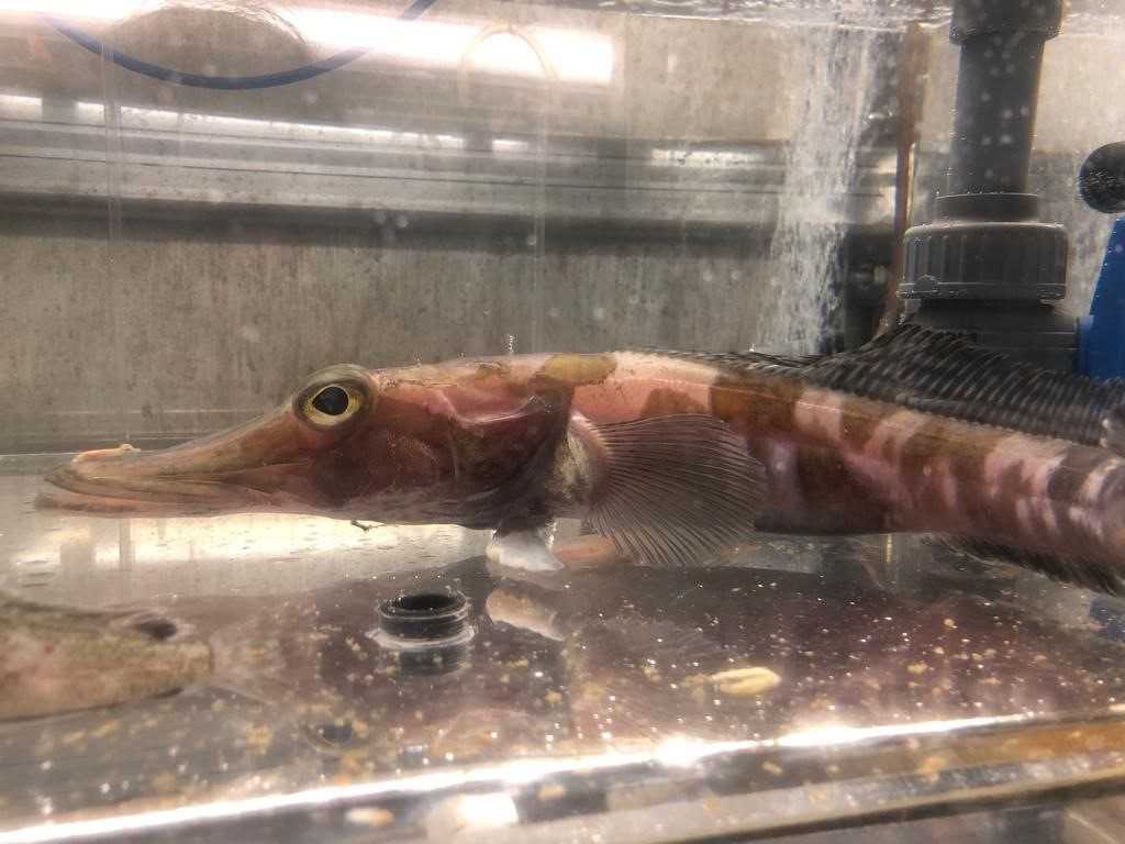
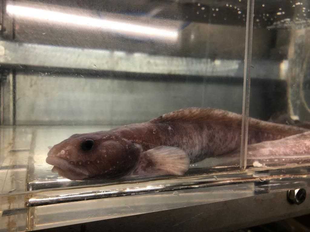
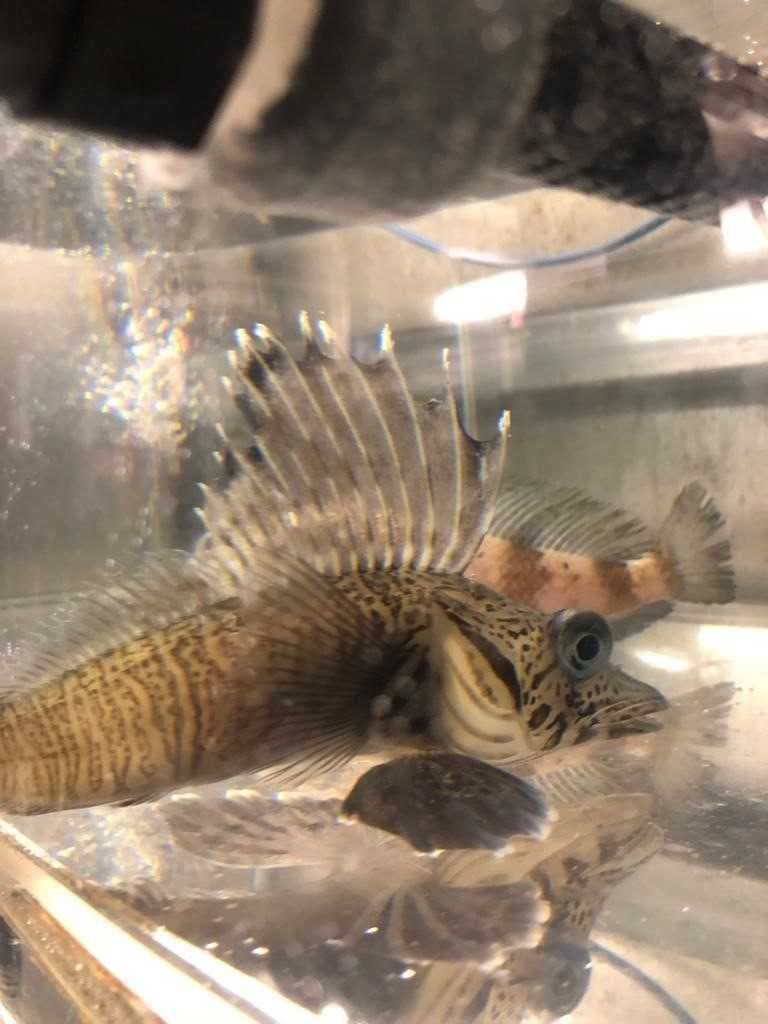
There are for instance, crocodile icefish, like Pagetopsis macropterus, they are particularly interesting species since they constitute the only known vertebrates to lack hemoglobin in their blood. It is thought to advantage the conservation of iron in an environment where iron is a limiting nutrient. They are ambush predators feeding on smaller fish but also krill. Pagetopsis macropterus particularly, is in its turn, heavily sought and predated by Weddell seals.
In the aquaria we can also find cod icefishes (like Trematomus scotti), as well as Antarctic dragonfish (Cygnodraco mawsoni), barbled plunderfishes (Artedidraco orianae) and Eelpouts (Pachycara brachycephalum). These are demersal and bathydemersal fish naturally feeding on errant polychaetes, amphipods and krill. Nevertheless, there are still many unknow aspects from the amazing physiology and ecology of these species and the scientist on board busy themselves to better understand these features and ultimately the species role in the ecosystem energy flow.
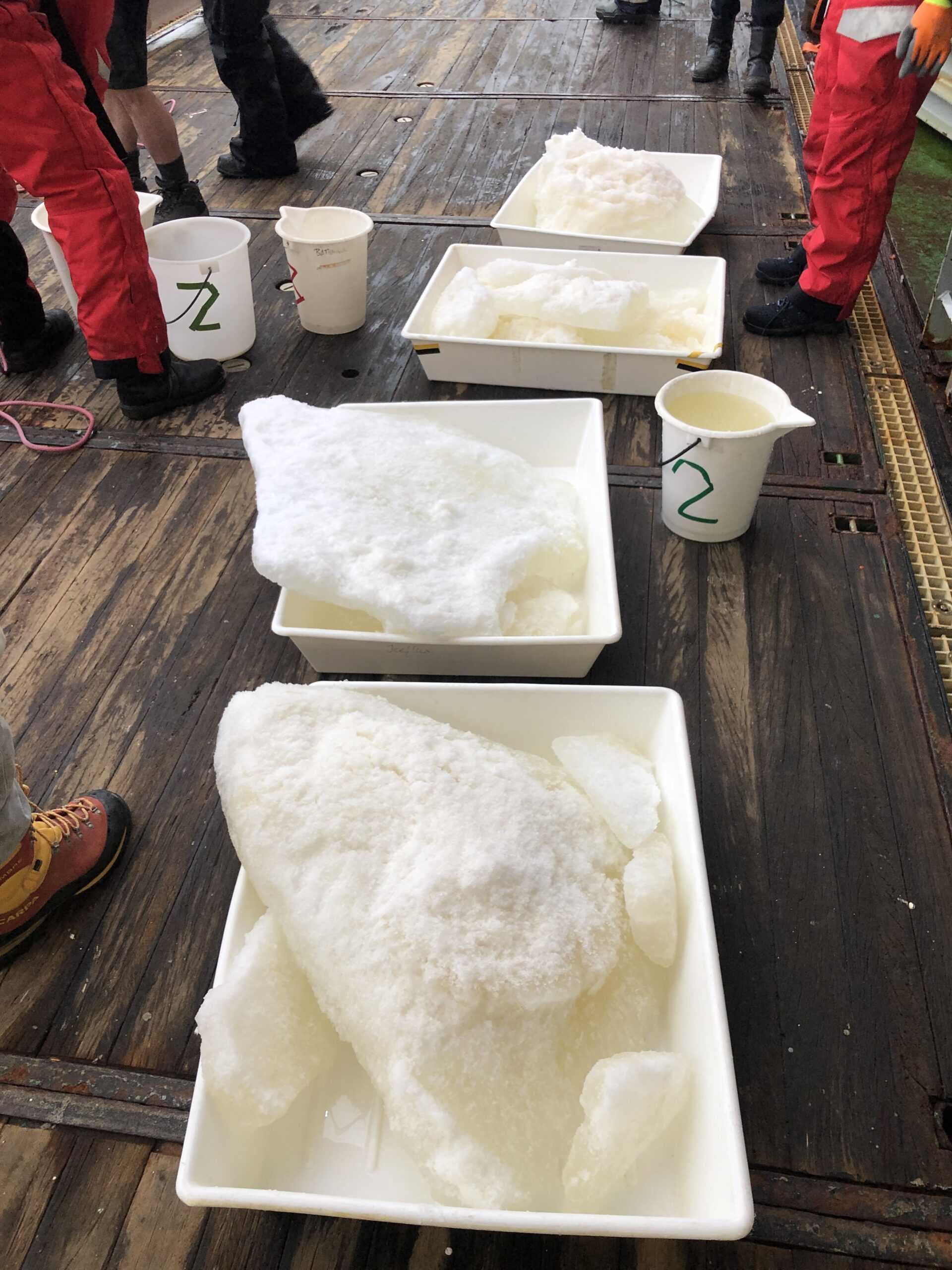
Unexpectedly, today in our way towards our next station across the Weddell Sea, we have stumbled upon an algae bloom. As far as the eyes could see, the water surface was covered in a brownish mosaic of snow-covered sea-ice floes framed with colored slush ice. In the Southern Ocean, these patches are usually created by a concentrated, rapid and ephemeral blossom of algae, mainly diatoms, in the water surface. Most likely, the algae bloom was triggered by an increase of iron in the water column, probably released through the melting ice of an iron-rich drifting iceberg.
Diatoms are unicellular microalgae that can live as solitary cells or in colonies and are a dominant component of phytoplankton. The cells are surrounded with silica walls that can be structurally colored and exhibit many different beautiful and artistic shapes. When the right combination of nutrients and sun light concur in a water patch, the natural living assemblage of diatoms can double its number in a matter of hours.
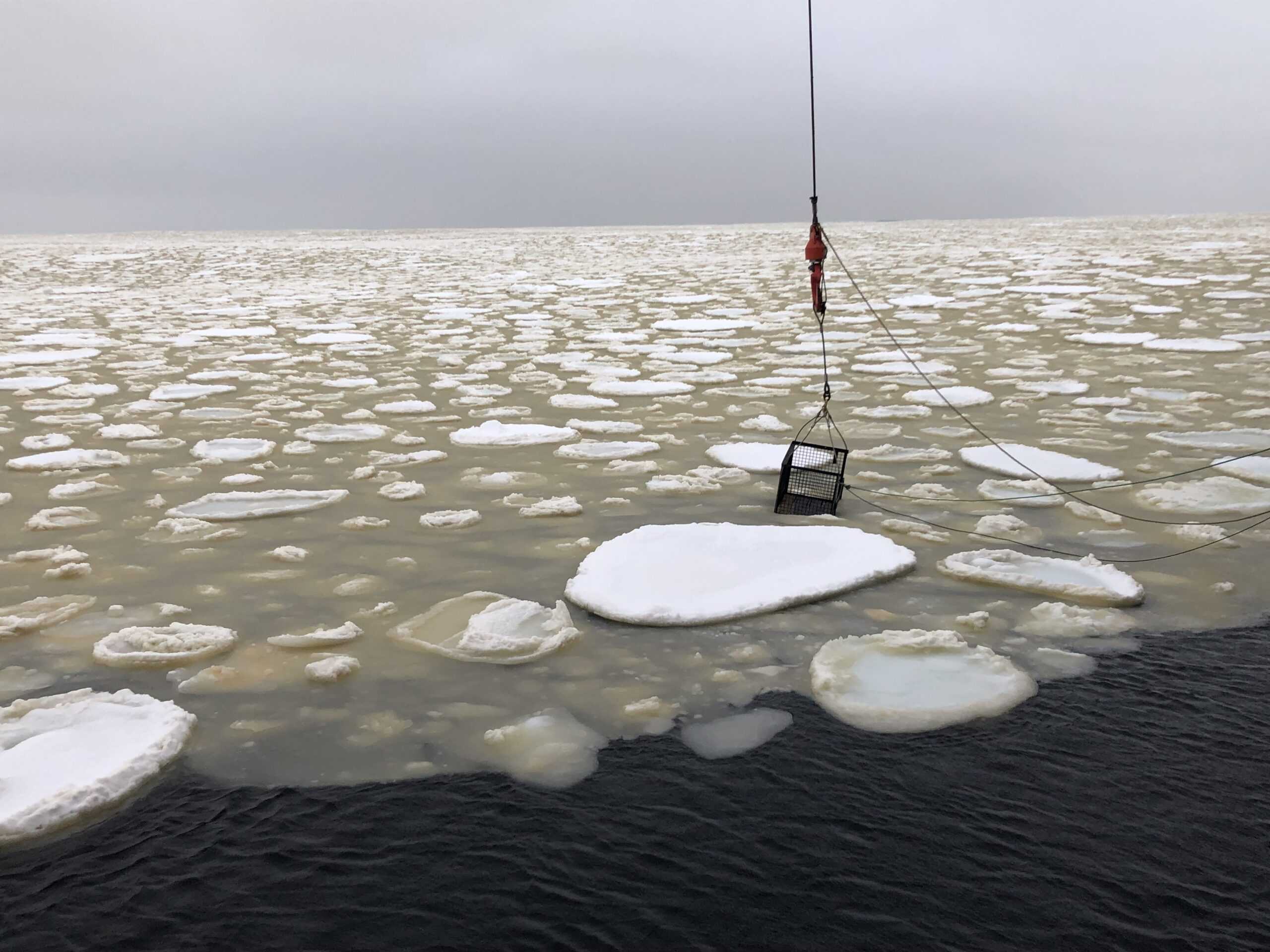
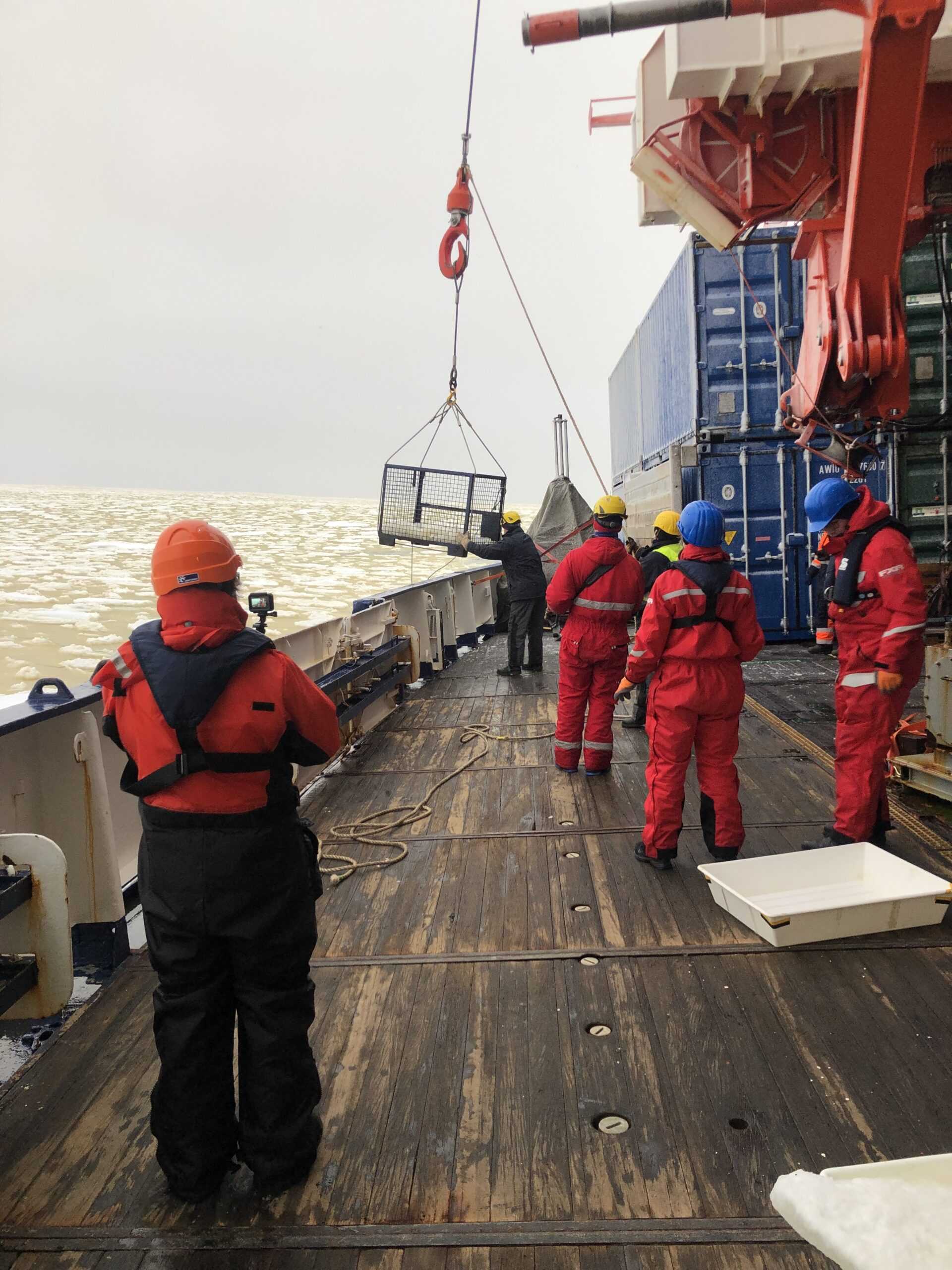
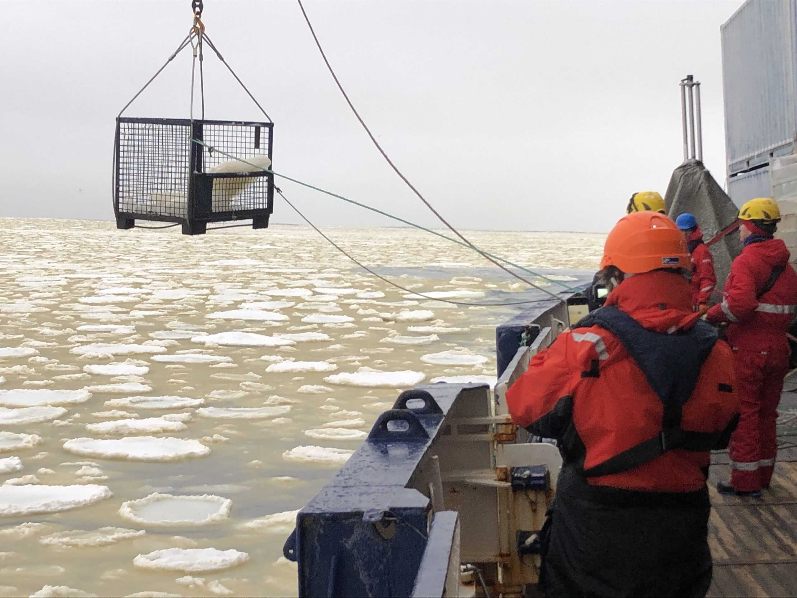
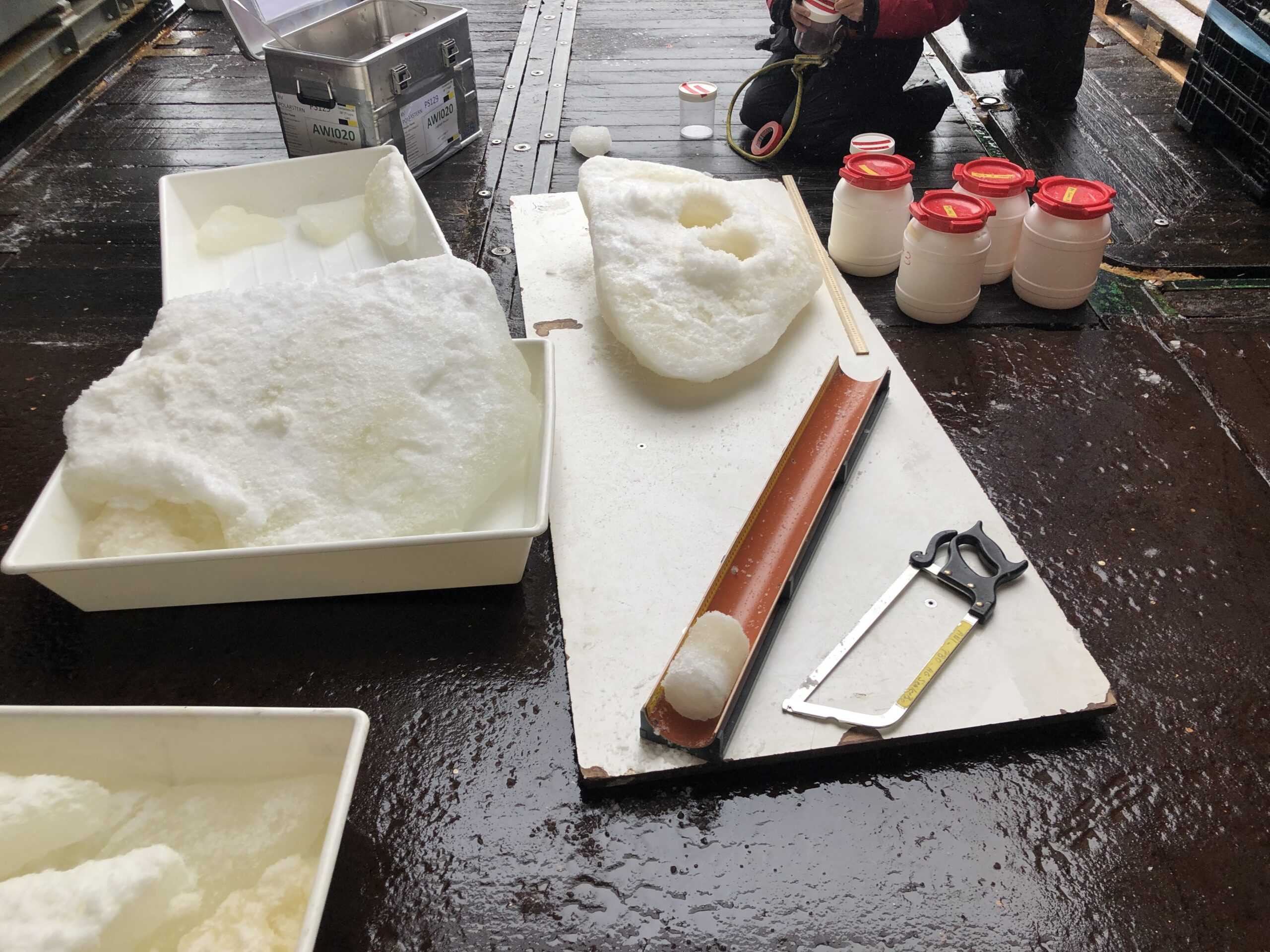
Scientist on board hurried up excited to the working deck where the crew has already prepared a metal basked that hoisted with the help of a crane allowed to sample some of the colored sea-ice floes for later analysis.

Despite global warming, the Antarctic sea ice has been slightly expanding during the last decades. However, during the austral summer 2016/2017 and specially in the eastern Weddell Sea, the sea-ice extent showed a strong decline when compared to the historical record. Furthermore, the overall trend in Antarctic sea ice during this past summer 2021/2022 seems to have reached new low records.
In this context, the colleagues on board from the international group DEFIANT (Drivers and Effects of Fluctuations in Antarctic sea ice) aim to better understand the processes controlling Antarctic sea-ice cover variability –like the historical decadal sea-ice expansion and the sporadic declines– to improve the accuracy of climate model’s predictions. For example, they will study the changes in freshwater forcing (glacial, precipitation, sea ice melt) through the continuation of a long-term study of the freshwater budget derived from seawater oxygen isotopic composition. They will also study the atmosphere-ice-ocean interaction by deploying buoys loaded with several sensors that will measure meteorological and oceanographic variables as well as the incoming sun-light spectra. This information coupled with descriptions of the snow/ice morphology and biological content will allow them to better understand the processes that trigger Antarctic sea-ice melt. In addition, they will contrast the snow and sea-ice characteristics of specific sea-ice floes with the patterns of the attenuated-return echo (electromagnetic waves) originally emitted from a small radar projected towards the same floes. This will allow them to better understand and interpret the returns from space-based sensors, such as CryoSat2. These sea-ice measurements will be undertaken either from above the ship using the mummy chair or directly on sea-ice floes reached from the ship or with the helicopter.

In parallel to the DEFIANT measurements, some scientist from the EWOS group will also work on the sea ice. They will use ROVs to monitor and sample the biota attached to the underside of floating shelf ice (cryobenthos). Additionally, they will collect sea-ice cores to sample for physical and biogeochemical sea-ice parameters to identify key variables driving the structure of the sea-ice environment. And last but not least, they will deploy SUITs to assess the taxonomic and functional biodiversity of ice-associated biota.
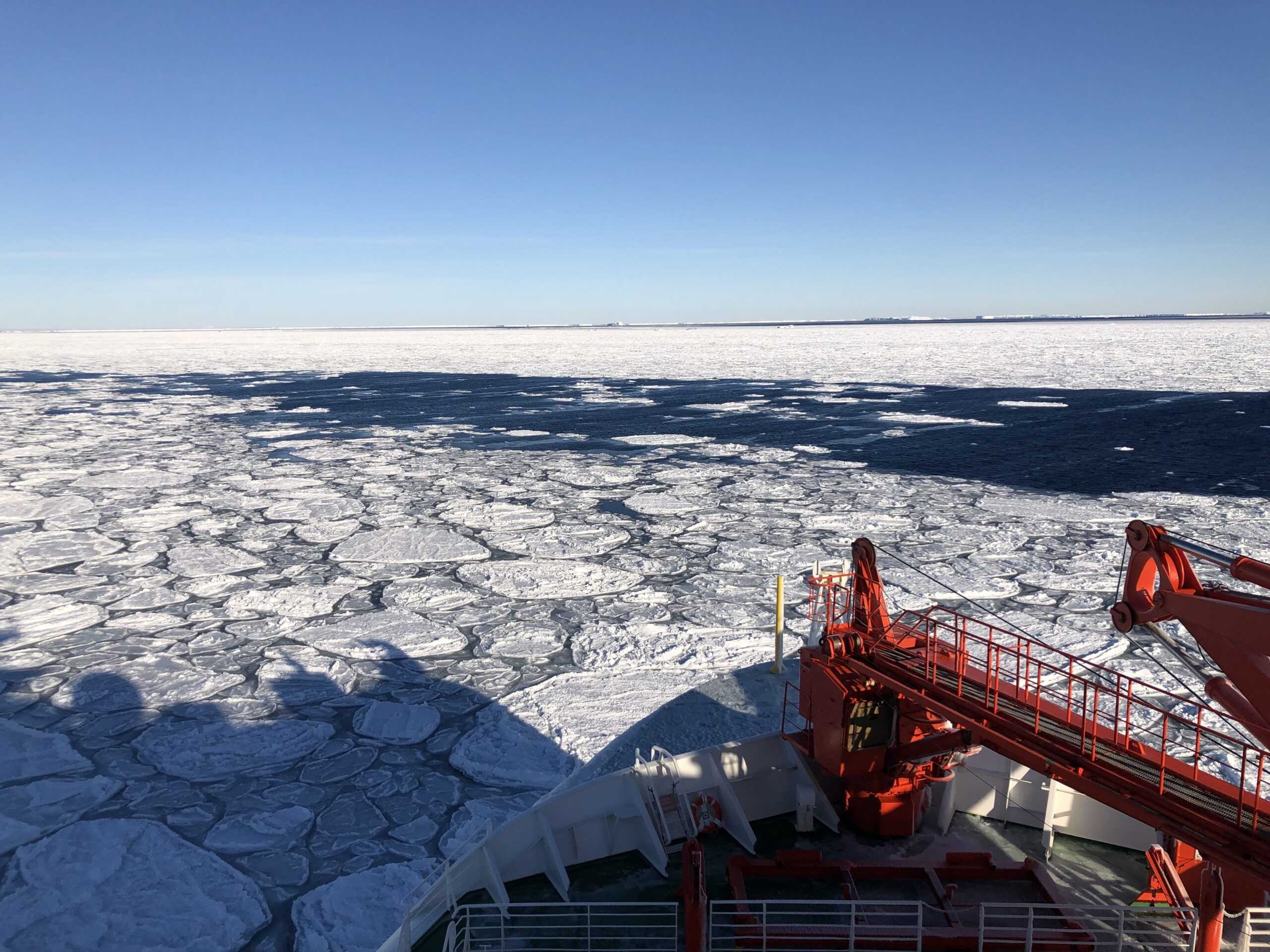
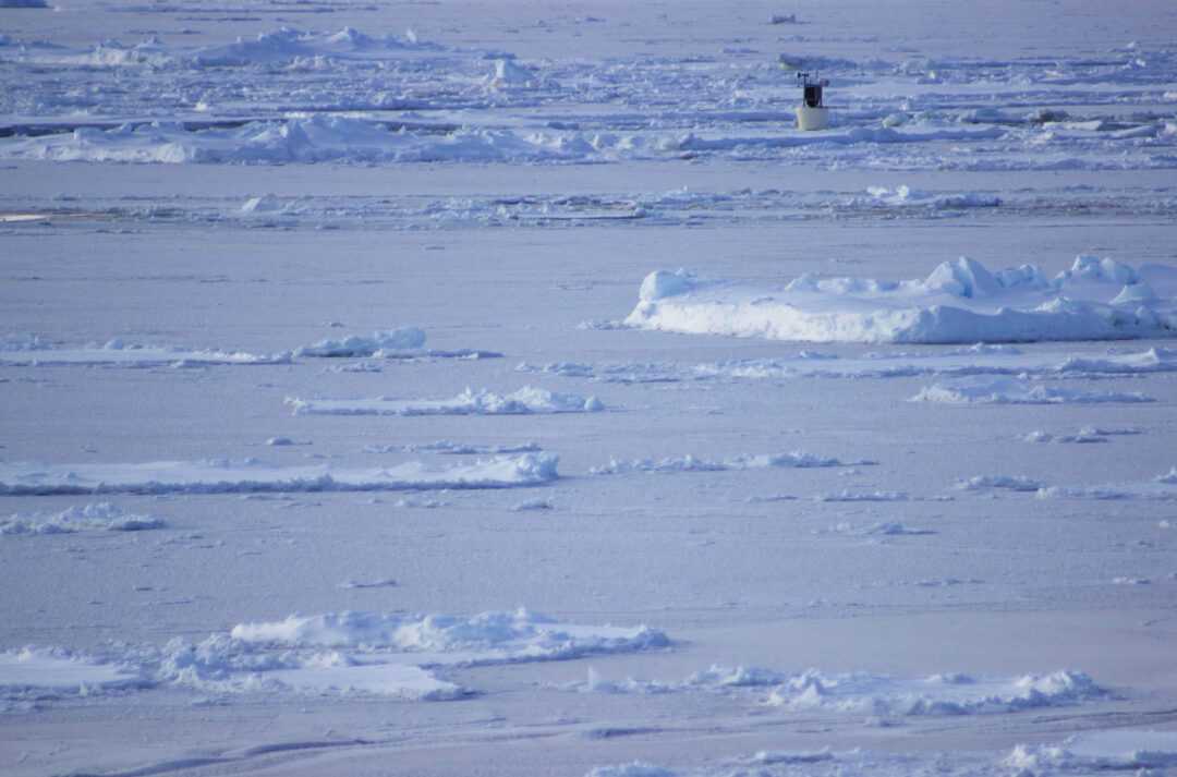
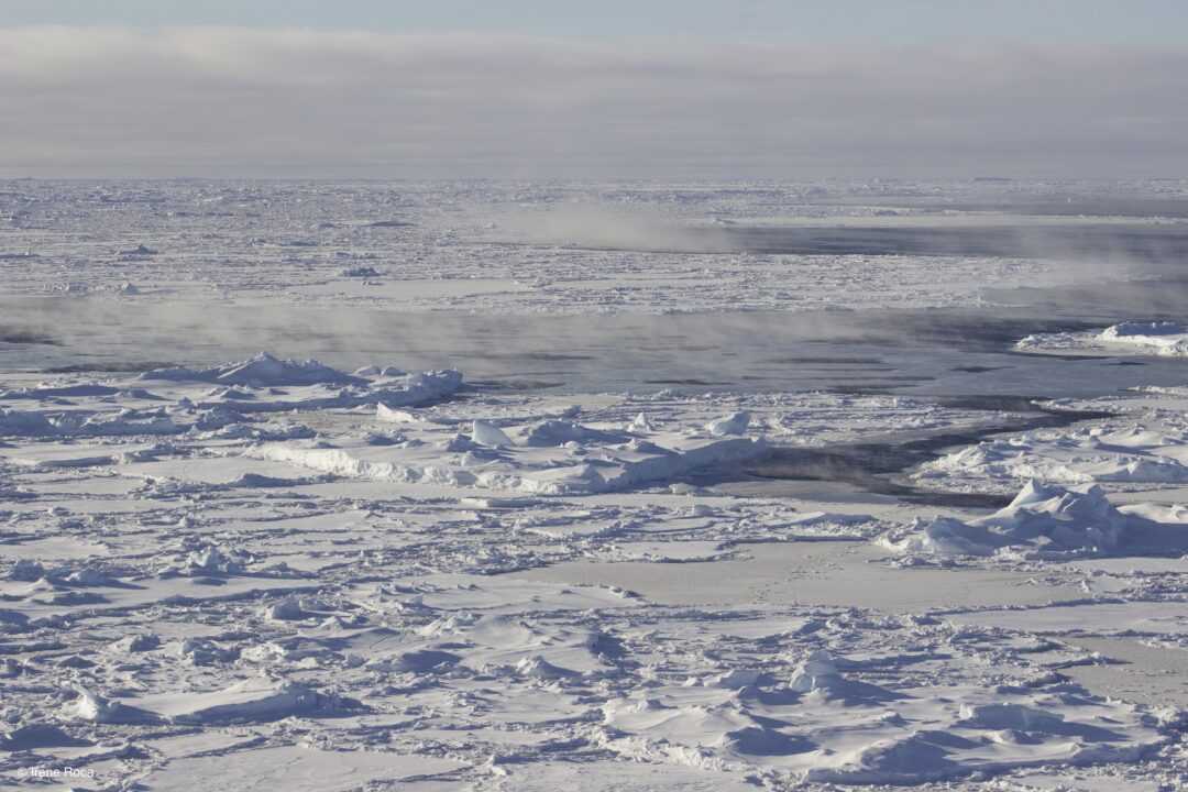
Some days ago, we left behind the pancake ice and moved deeper into the pack ice. Everywhere around the ship big and thick sea-ice floes were densely packed together creating a coarse and shiny surface frequently crested with icebergs of heterogeneous shapes and sizes. Occasionally, this white surface was breached by thin and meandering water openings, also called leads. From the leads ice smoke raised under the bright sun’s light, as a token of the sea-ice forming process which was happening directly under our bare eyes. Temperatures dropped to less than -30ºC and with the first lights of dawn we discovered delicate ice flowers covering every corner of the frozen surface of the ice floes.
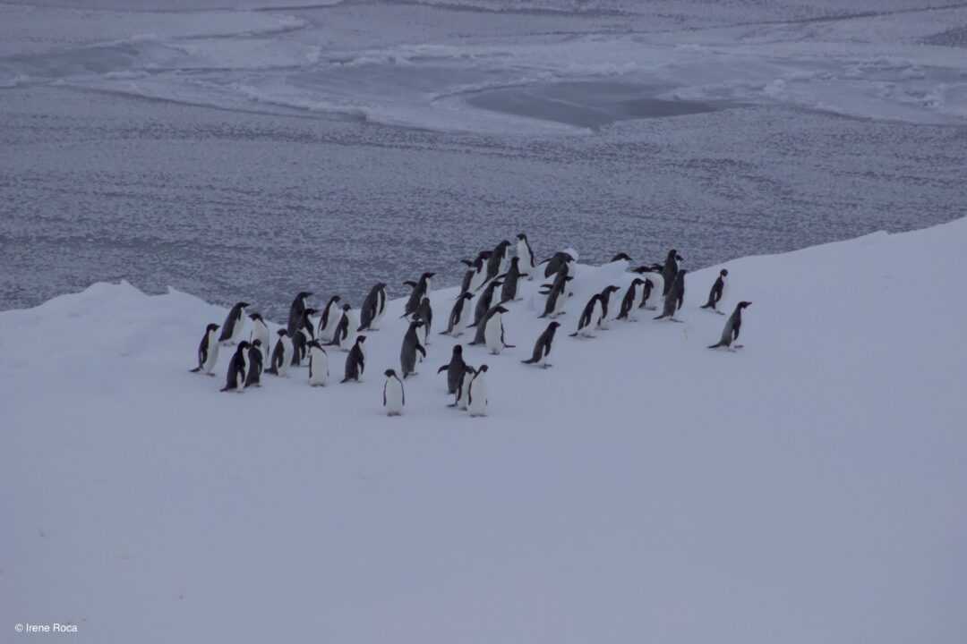
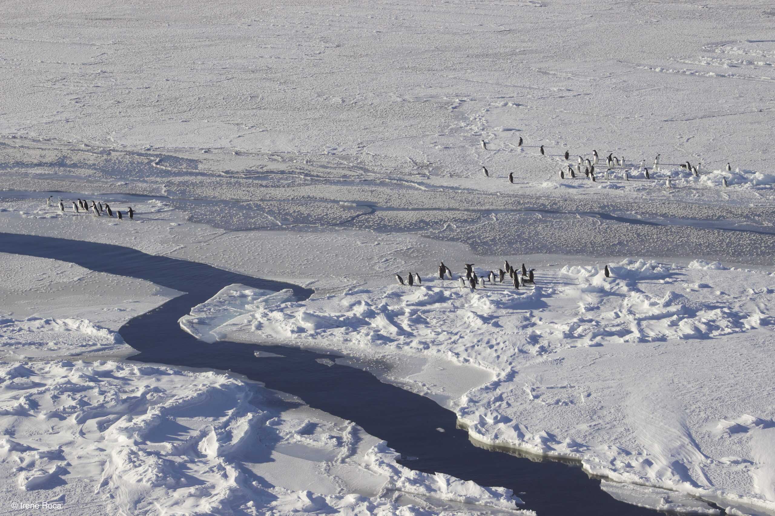
While on the pack ice, we often saw groups of Adelie penguins resting nonchalantly on top of the sea-ice floes. However, once they saw or heard the Polarstern, they hurried away from the ship frantically beating their short legs and with their flippers swinging along in disarray. Curiously, they seemed to follow one specific individual taking the lead and all behind in line moved away from the approaching threat.
Yesterday, from the helicopter, in the return trip to the ship after the rutinary marine mammal survey from the air, some colleagues saw something dark in the middle of the steamy waters of an open lead. They turned around with the helicopter to carefully observed what it was. Four adult Arnoux’s Beaked whales were sticking their pointy head out of the water!
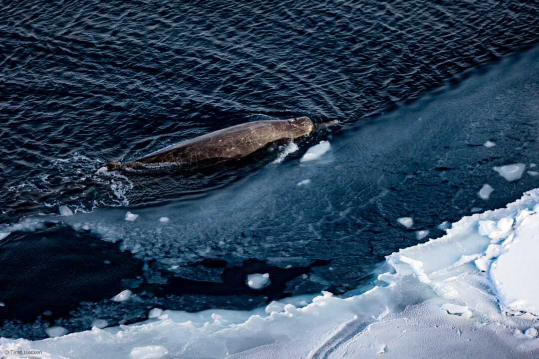
Like most of the species from the Ziphiidae family, these cetaceans are in general very inconspicuous in the water surface and sightings are very rare. The Arnoux’s Beaked whales are deep divers, they can spend up to one hour under the water feeding on large squid, octopus and fish. They exhibit a small head with prominent long beak and moderately steep melon continuing in a dark blue-black to pale brown body with very small fins but comparatively large flukes. Adults typically show a scarred back, thought to be the result of their encounters with giant squids and/or killer whales. Little else is known about these amazing creatures that our colleagues found happily swimming between ice floes.
We are currently sampling along the last transect of our expedition, which will end with a last station near Elephant Island. The pack ice has been growing fast during the last weeks, extending its icy fingers in all directions within the Weddell Sea basin, while relentlessly urged north by cold southerly winds. Hence, the transect is now completely surrounded by sea-ice which restrains our navigation speed, complicates the ship’s movements and hence the scientific work on board.
A couple of days ago, in our way south towards the position for a mooring deployment the ship’s radar detected a mighty and crocked barrier of drifting icebergs spanning approximately 40 nautical miles. Most likely, these icebergs were calved from the Antarctic Peninsula’s ice shelfs or from those far beyond within the Weddell Sea and were drifting driven by the Weddell Gyre. However, close to the position of our intended station, they found resistance and were slowed down by the northward growing force of the sea-ice edge, forming therefore the barrier that we observed.

Some colleagues from the DEFIANT group flew with the helicopter over and beyond the icy barrier to study the sea-ice cover. They reported a frozen landscape dominated by rafted ice and pressure ridges. After stumbling upon the strong iceberg wall, the rapid advance of the drifting pack ice was most likely blocked, increasing the pressure between the ice sheets and causing the complex and severe deformation of the sea-ice cover. This thick and sharp-crested ice surface could not be possibly navigated through without taking great risks, even by a specialised ice-breaker like Polarstern. Consequently, we were forced to leave and search for a more optimal location where we could deploy our deep-sea mooring and continue our research activities on board.
During our last transect we are increasing the frequency of the CTD-rosette casts. We want to capture the spatial variation in the physical and biological parameters of the different water masses along the western continental slope. Especially, this will allow us to better understand the properties and temporal changes of the Weddell Sea bottom and deep-water masses.
The Weddell Sea Bottom Water (WSBW) has its origins along the continental shelf west of the 40°W. There, the strong and cold winds blowing off the Antarctic continent cool and oxygenate the surface water, which also increases its salinity content due to the sea-ice formation process. This brine (dense and cold-water mass) descends until the continental shelf’s edge, occasionally receiving even colder inflow from under the ice-shelf. It immediately starts mixing with the Warm Deep Water mass above and it is at this stage that this bottom water mass becomes the WSBW. It flows clockwise along the Weddell Gyre across the Weddell Sea basin. Kept by the Gyre and also topographically constrained by the shallower edge of the Scotia Ridge, this dense bottom water is mainly confined to the basin. However, in its course, the mixing process with the upper warmer water mass continues and forms the Weddell Sea Deep Water (WSDW). Less dense, the WSDW is able to escape the Weddell Sea basin through deep passages and flows into the rest of the world’s oceans.

It is indeed the WSDW –called the Antarctic Bottom Water (AABW) once it leaves the Weddell Sea basin– which plays a major role in the global circulation of the world’s oceans. It cools and oxygenates the bottom layers of the adjacent water masses and ventilates therefore the deep waters from the oceans of the world.
Looking at the physical properties of the water masses that our CTD-rosette encounters during the current transect, we can clearly discern the presence of the WSDW and WSBW, with temperature ranges of 0 to -0.7ºC and -0.7 to -1.8 ºC respectively.
There is a new surge of activity on board. Scientists prepare their samples and carefully store them in the ship’s cold rooms and freezers to be kept safe until the Polarstern returns to Germany. We also busy ourselves packing the containers on board with all the equipment we have been using these past two months. During the last 4 days of expedition, we will cross the Drake Passage and everything needs to be ready and tied up in case of storm.
Sadly, the expedition is coming to an end. Yesterday we left behind the northward advancing edge of the sea-ice and today we have sampled our last station near Elephant Island (South Shetland Islands). We have recovered a mooring, deployed another and brought to a close the “grand finale” with a shallow CTD-rosette cast.
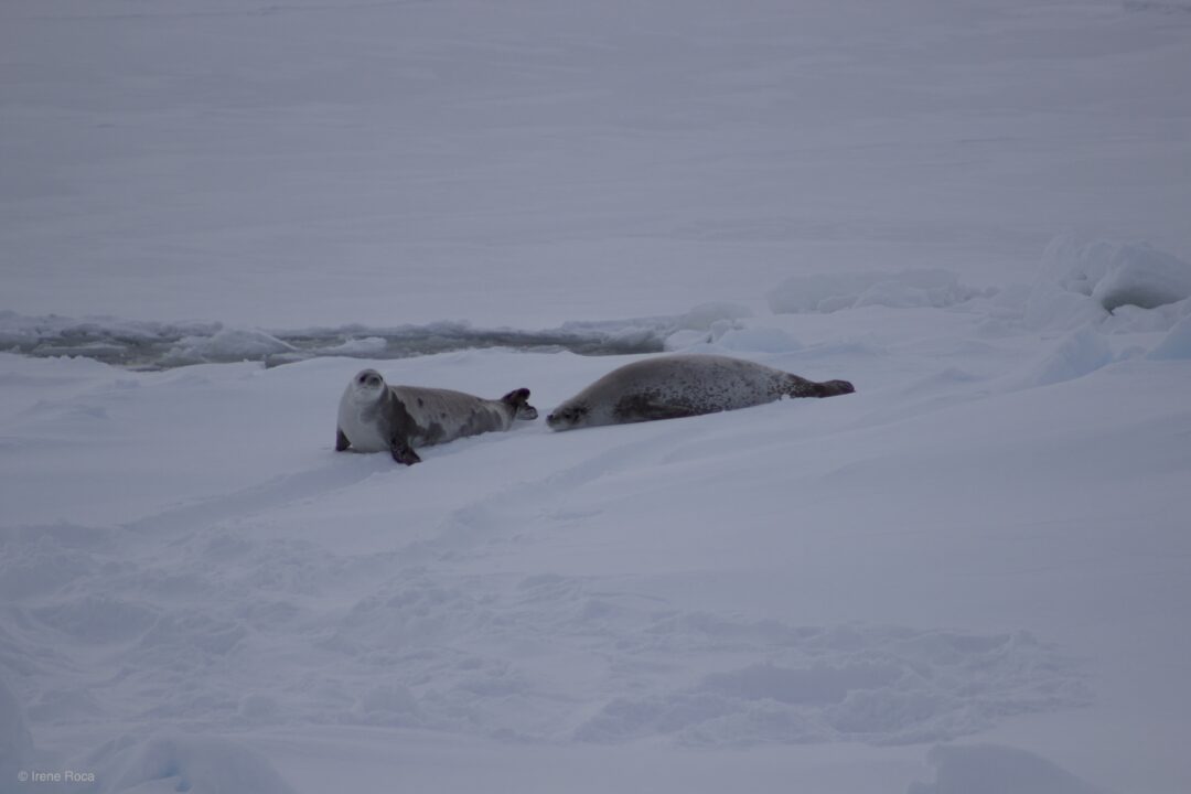
On board, I’m in charge of browsing through the acoustic files that we have recovered as a preliminary analysis of the spatial and temporal distribution of the recorded species. Varying with the location of the recovered deep-sea moorings, I can clearly listen to the beautiful calls produced by big Antarctic blue whales, Antarctic minke, fin and humpback whales, the clicks and whistles of sperm and killer whales and the sweeps, moans and trills of Weddell, crabeater, leopard and Ross seals.
These recordings are part of the HAFOS long-term wide-range passive acoustic monitoring (PAM) database from the Weddell Sea. Particularly in the Southern Ocean, PAM is extremely useful. It allows to access information on vocal species diversity, spatial and temporal distribution and inter- and intraspecific behaviour in a region where more traditional –visual– species surveys are otherwise challenging and even impossible to achieve in particular seasons.
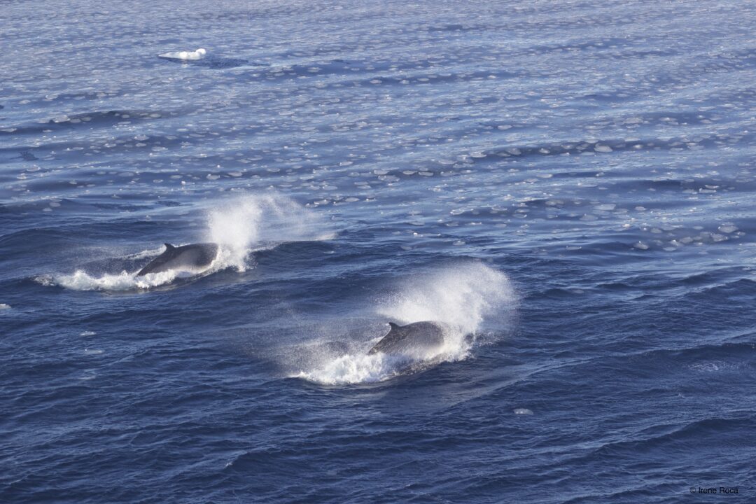
Surprisingly, the crossing of the Drake passage went very smoothly, we had soft winds and very low swell. The air temperature quickly raised and melted the ice and snow that had been covering the ship during our journey through the Weddell Sea. There was also a clear succession in the species that approached curiously the ship. Upon our arrival to the Atlantic entrance to the Magallanes strait we were able to observe, among other species, elegant black-browed albatrosses, great shearwaters and Antarctic shags, as well as Magallanic penguins and small hurried Commerson dolphins.

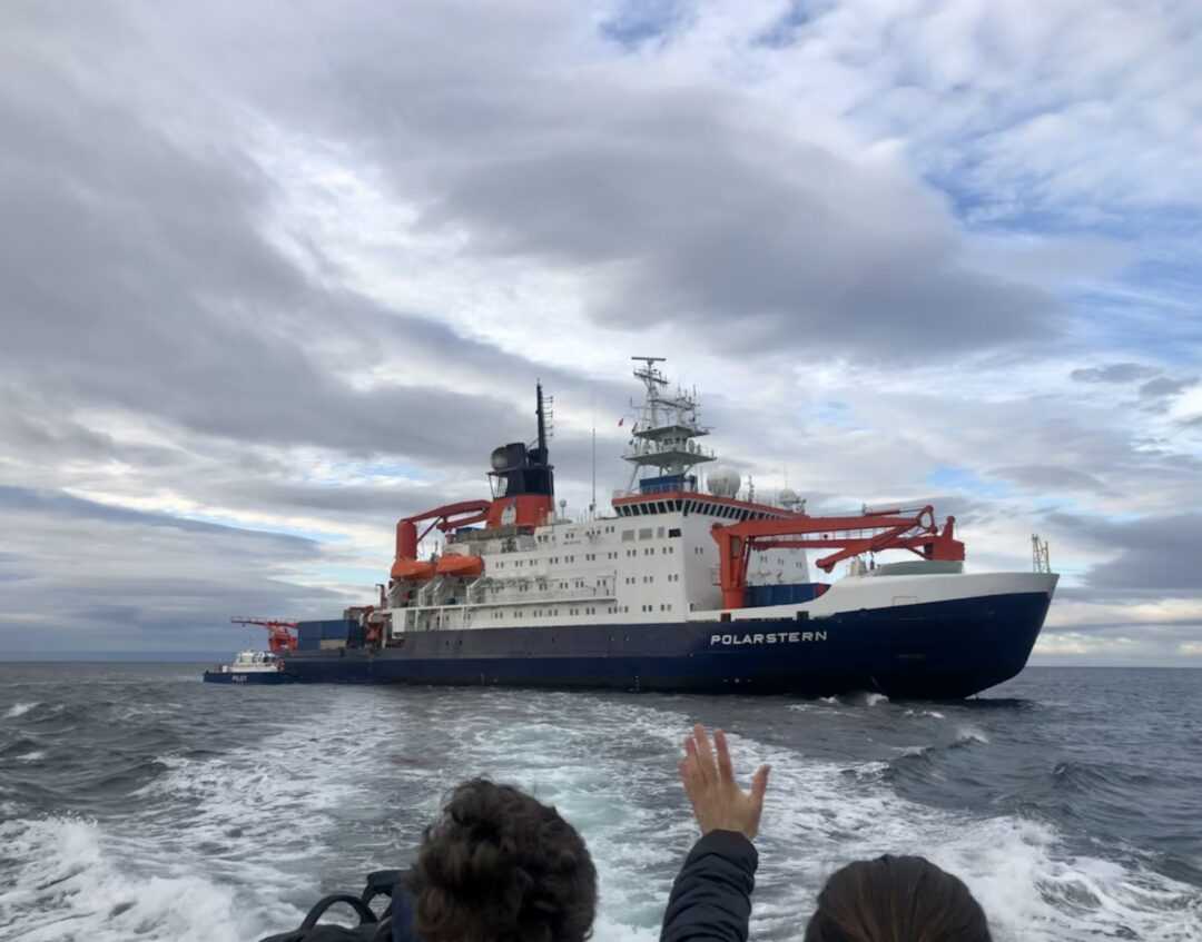
In the late morning of the 28th, two Chilean pilot boats arrived to position themselves side by side the Polarstern anchored off Punta Arenas. The PS129 expedition to the Weddell Sea was over and sadly, the moment had come for the scientists on board to leave the ship. After saying our goodbyes to the crew members and thanking them for their immeasurable help, patience and kindness, which greatly facilitated our scientific work and stay on board, the pilot boats carried us all ashore in groups of 6 at a time. Aboard the smaller ship I contemplated the now-familiar shape of the Polarstern fade in the distance, with its official flags fluttering high and proud in the wind.
Two months of research through the Southern Ocean on board of the Polarstern are over. People from ten different nations have been working and living together in peace during this time, united with the same goal to better understand the Southern Ocean’s ecosystem and dynamics, especially in light of current global anthropic pressures. As one of the Earth’s last marine wildernesses on Earth, it is our responsibility to find a way forward to provide long-term mitigation of growing pressures (overfishing, tourism, climate change) to sustain the integrity and functionality of the Southern Ocean’s marvelous and unique ecosystem.